Refectory at Easby Abbey by munki-boy
Easby Abbey (ruin)
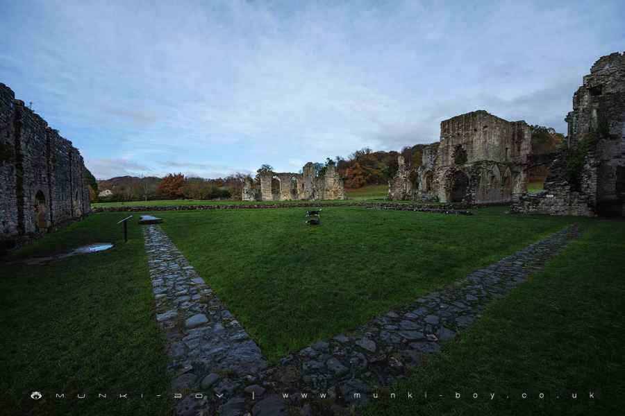
Easby Abbey was known in the Middle Ages as the Abbey of St Agatha by Richmond. It was founded in 1151-2 by Roald, constable of nearby Richmond Castle.
Easby was a house of Premonstratensian canons, the third house of this order to be founded in England. They were an order of regular canons’, meaning communities of ordained priests living together, rather than monks who take vows but are not ordained.
There had been a Saxon ‘minster’ at Easby before the Norman conquest, a church served by a small community of priests. This older church is likely to have been on the site of the present parish church of St Agatha, which remains in use and is open to the public.
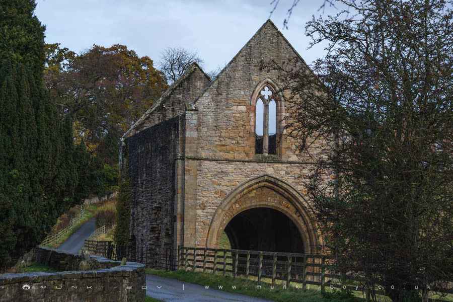
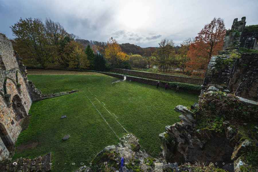
Ahead of you, with its fine facade, stands the outer west range. The first floor may have been the abbey’s guest house. The lost upper floor probably housed the canons dormitory; and the leaning section on its far left housed the drains of their latrines.
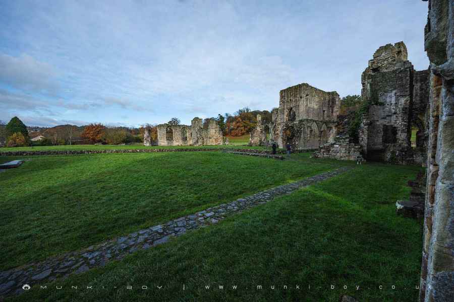
The abbey kitchen, recognizable by its large fireplaces was linked by a servery to the infirmary hall, the the sick may have been tended here. However, the buildings do not all follow normal monastic planning. There were several more domestic looking spaces opening off and above these rooms, equipped with fireplaces and latrines.
A long first-floor room with a small chapel opening off it, may have been the abbot’s private chamber. Other well-appointed rooms might have provided accommodation for honoured guests, such as the Scropes of Bolton. This rich and powerful family remained patrons of Easby until its suppression by King Henry VIII in 1536-7.and subsequently took over the abbey and many of its estates.
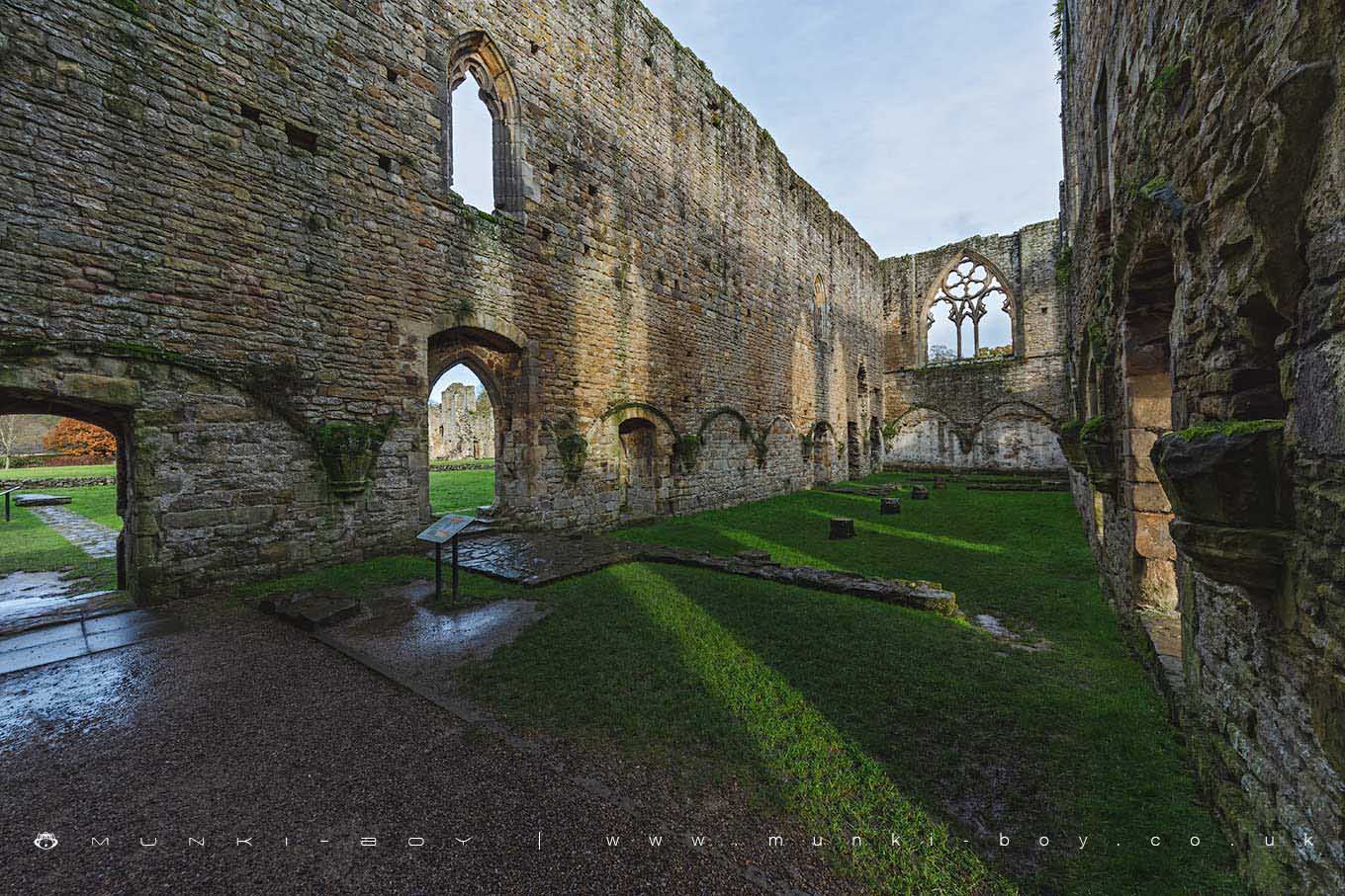
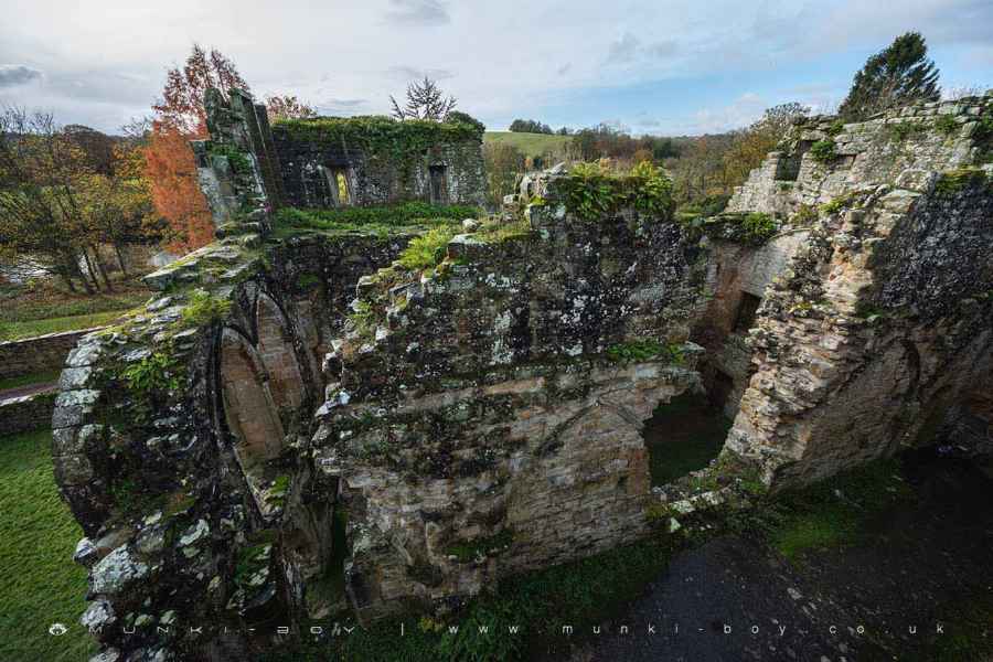
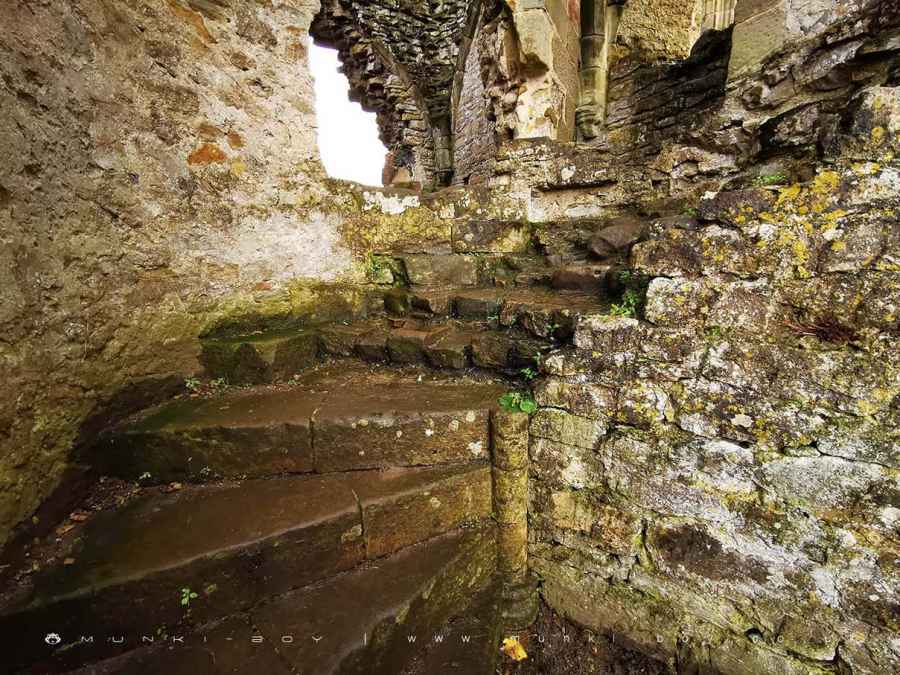
The refectory or dining room is the most impressive part of the abbey ruins. Probably dating from the later 12th century, it was magnificently rebuilt in the late 13th century, with large windows to bring in more light. Here the cannons are there simple, mainly vegetarian meals in silence.
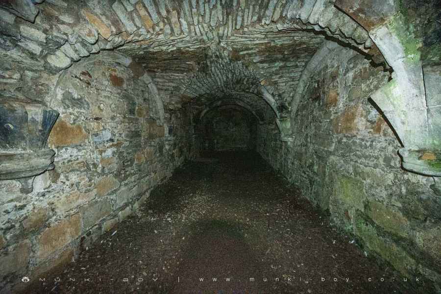
The building was divided into two floors. with the ground floor undercroft probably used for storage The arches of its vaulted ceiling are still visible along the lower walls, Above this was the refectory itself.
At the end of the refectory the great east window, beneath which was the abbot’s table. To its right, the second window housed a fine raised pulpit from which one of the canons read from the scriptures during to meals.
The food was prepared in an adjacent kitchen and passed through a hatch in the refectory wall. The foundations and central hearth of the kitchen can be seen in the grass, to the south outside this building.
Easby Abbey was painted by Turner around 1797.
Created: 24 November 2019 Edited: 29 November 2023
Easby Abbey Information
Easby Abbey Address
Easby, Richmond, North Yorkshire
DL10 7EU
Website: https://www.english-heritage.org.uk/visit/places/easby-abbey/
Get directionsEasby Abbey (ruin) LiDAR Map

Contains public sector information licensed under the Open Government Licence v3.0
Local History around Easby Abbey (ruin)
There are some historic monuments around including:
Ravensworth motte and bailey castle, water defence features, park pale and shrunken medieval villageThe Bargate, medieval gatewaySection of Scots Dike linear boundary south of Kirklands FarmSection of Scots Dyke linear boundary 150m ENE of OlliverRichmond BridgeMedieval cross base known as Plague Stone, 750m WSW of High ScalesSection of Scots Dyke linear boundary running south from Olliver East for 550mRichmond Castle: eleventh to fourteenth century enclosure castleSection of Scots Dike linear boundary north of Kirklands FarmSt Martin's Benedictine Priory, RichmondEasby Abbey Premonstratensian monastery: monastic precinct, cultivation terraces, water-management features and ancillary buildingsSection of Scots Dike linear boundary north west of High MerrybentSection of the Scots Dyke linear boundary 225m south of St Martin's PrioryMedieval village of Hunton and field systemFranciscan friaryRound barrow 650m north west of Winterfield HouseSection of the Scots Dyke linear boundary 250m south east of St Martin's PriorySection of Scots Dyke linear boundary 75m south west of Sandford HouseCataractonium Roman forts and townSt Giles medieval hospital, post-medieval farmstead and Iron Age occupation site immediately north of St Giles FarmWest Hauxwell churchyard cross18th century copper mill 80m north west of Copper Mill BridgeSection of Scots Dyke linear boundary and portion of field system 100m east of Whitefields Farm.