Dunstanburgh Castle by munki-boy
Dunstanburgh Castle
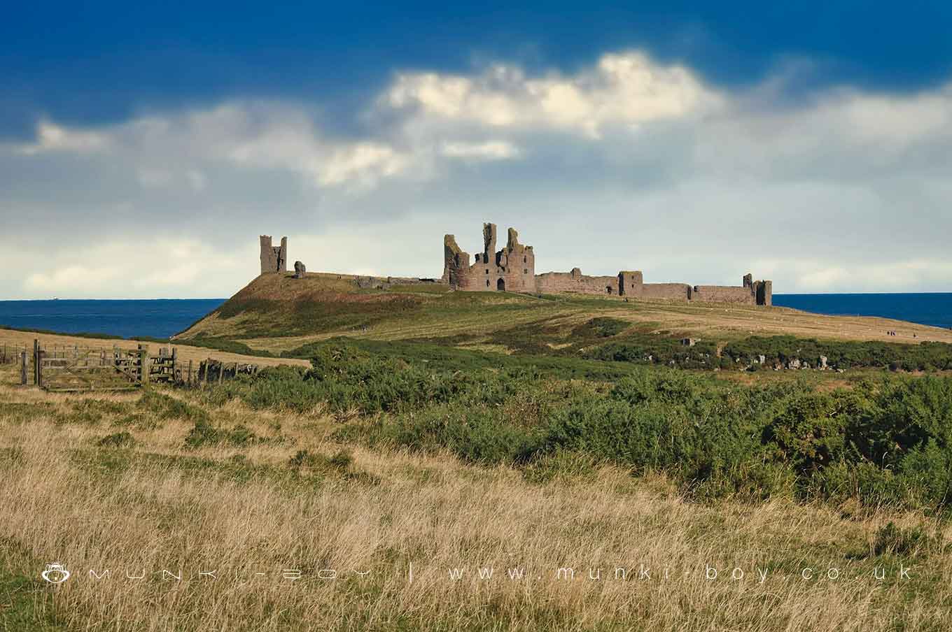
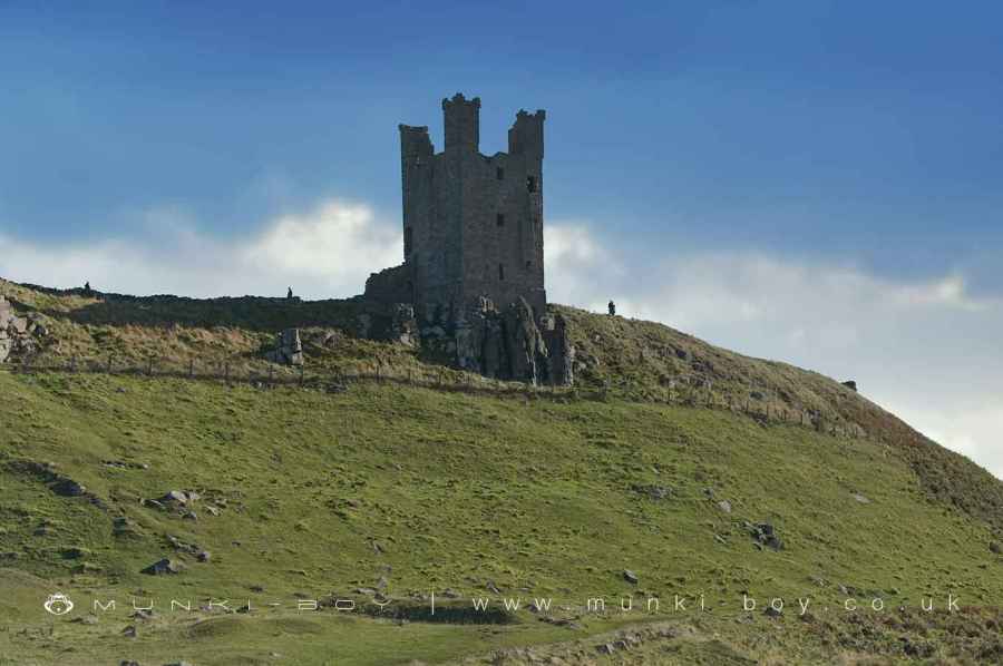
Dunstaburgh Castle is in a quite ruinous state but its setting and surroundings look great. The closer one looks the more detail appears in the form of interesting geology for the castle is built on a massive outcrop of the Whin Sill igneous rock. Further still, there is a wealth of historic sites in the surrounding landscape from remains of WWII defences to evidence of limestone quarrying and at least one fairly intact limekiln.
Dunstanburgh Castle was first established in 1313 by Thomas, Earl of Lancaster (c1278 - 1322), cousin to King Edward II and one of his most powerful opponents. The new castle was specially designed to impress visitors with Earl Thomas’s power and authority as one of the country’s leading barons.
Earl Thomas, arrogant and unpopular, was the leader of the political opposition to King Edward II and his favourite, Piers Gaveston, Earl of Cornwall. In June 1312, Earl Thomas’s supporters arrested and executed Gaveston, an act for which Edward II never forgave him. Dunstanburgh Castle was begun immediately afterwards on land which Thomas had inherited from his father. As well as giving him protection, the castle was built to imply that Earl Thomas
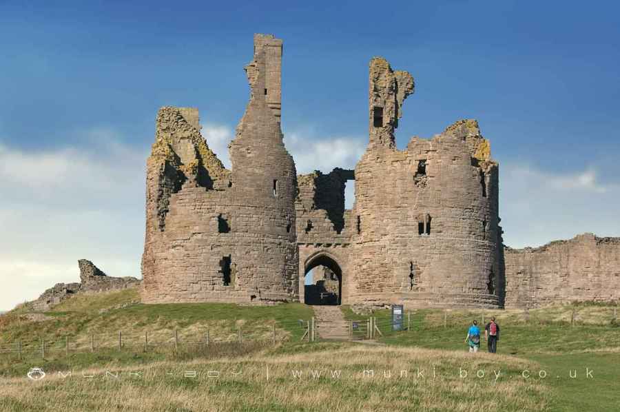
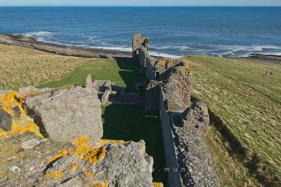
The castle’s builders exploited the natural setting to create several imposing views towards the castle. From the direction of Embleton, the walls and towers were reflected in the waters of artificial lakes or,’meres’. From the coast to the north, the castle was crowned by the Lilburn Tower, built on the highest point of the site. But the most striking building, the twin-towered gatehouse, was designed to create an imposing spectacle for those arriving by sea.
During an archaeological survey in 2003, the remains of a medieval stone jetty were found on the foreshore directly in front of the gatehouse: for Earl Thomas and his most important guests, this was the most impressive approach to the castle.
Dunstanburgh Castle: Romano-British settlement, 14th century enclosure castle and harbour, and World War II pillbox and foxhole.
An enclosure castle is a defended residence or stronghold, built mainly of stone, in which the principal or sole defence comprises the walls and towers bounding the site. Some form of keep may have stood within the enclosure but this was not significant in defensive terms and served mainly to provide accommodation. Larger sites might have more than one line of walling and there are normally mural towers and gatehouses. Outside the walls a ditch, either waterfilled or dry, crossed by bridges may be found. The first enclosure castles were constructed at the time of the Norman Conquest. However, they developed considerably in form during the 12th century when defensive experience gained during the Crusades was applied to their design. The majority of examples were constructed in the 13th century although a few were built as late as the 14th century. Some represent reconstructions of earlier medieval earthwork castles of the motte and bailey type, although others were new creations. They provided strongly defended residences for the king or leading families and occur in both urban and rural situations. Enclosure castles are widely dispersed throughout England, with a slight concentration in Kent and Sussex supporting a vulnerable coast, and a strong concentration along the Welsh border where some of the best examples were built under Edward I. They are rare nationally with only 126 recorded examples. Considerable diversity of form is exhibited with no two examples being exactly alike. With other castle types, they are major medieval monument types which, belonging to the highest levels of society, frequently acted as major administrative centres and formed the foci for developing settlement patterns. Castles generally provide an emotive and evocative link to the past and can provide a valuable educational resource, both with respect to medieval warfare and defence and with respect to wider aspects of medieval society. All examples retaining significant remains of medieval date are considered to be nationally important.
Dunstanburgh Castle is a well-documented example of an extensive enclosure castle with its own harbour and associated outworks. Its importance lies not only in the good state of preservation of its standing remains but also in the range of ancillary features which survive throughout the castle and the adjacent area as buried features and include the buildings of its home farm. Also of importance is the earlier use of the site during the Romano-British period, and its later reuse during World War II.
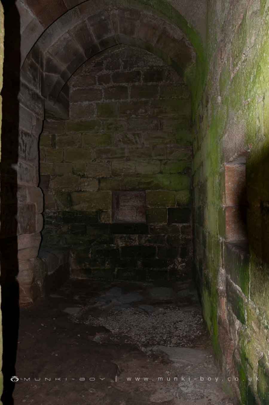
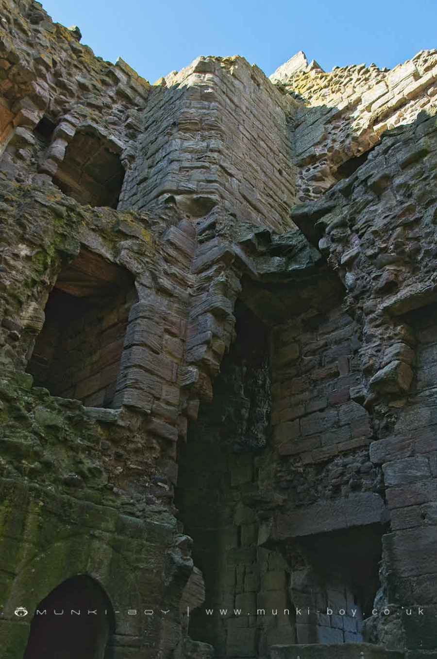
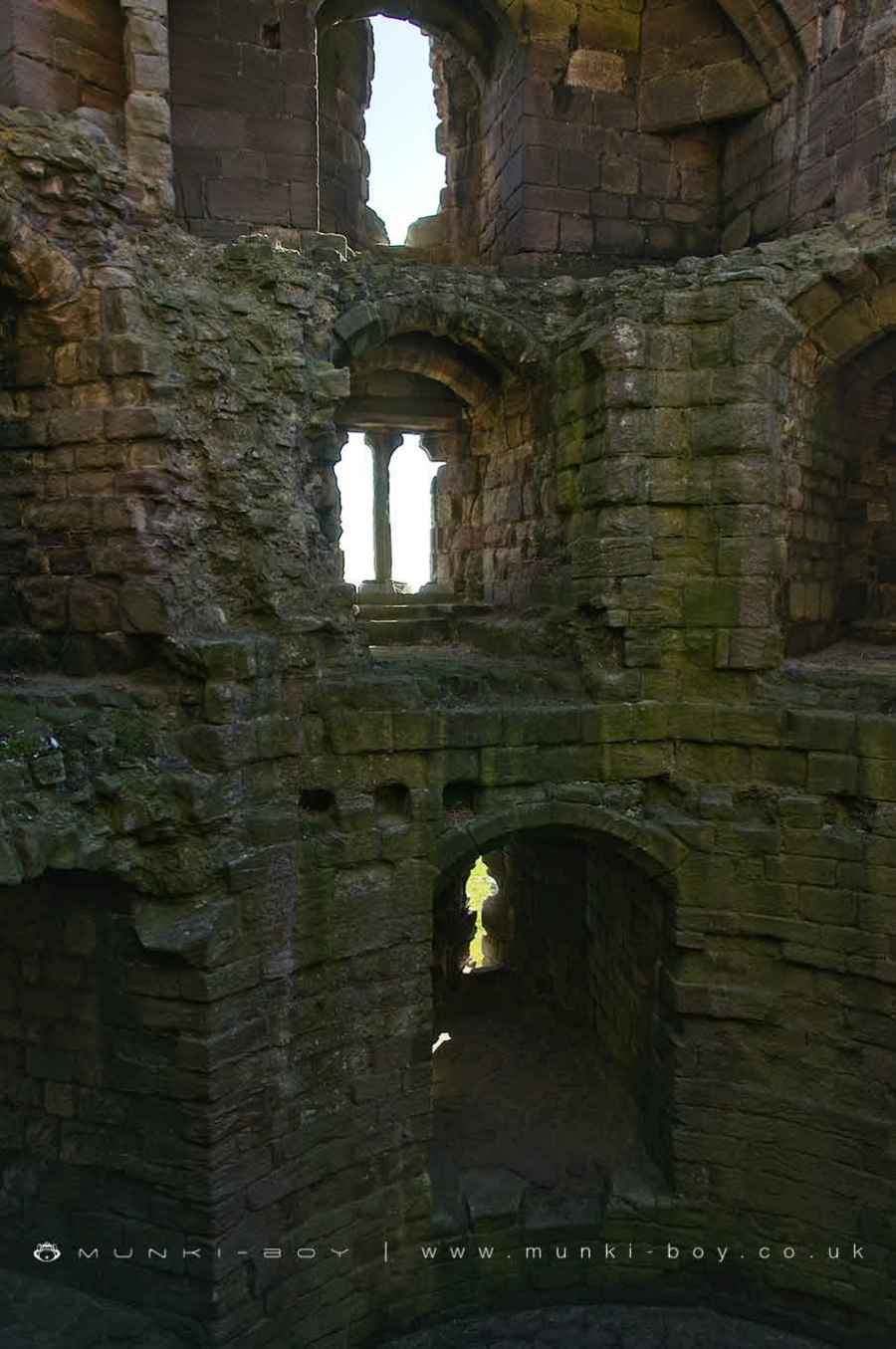
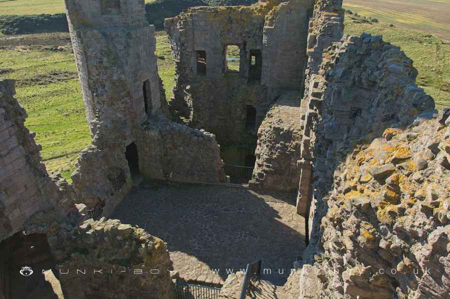
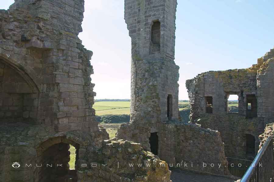
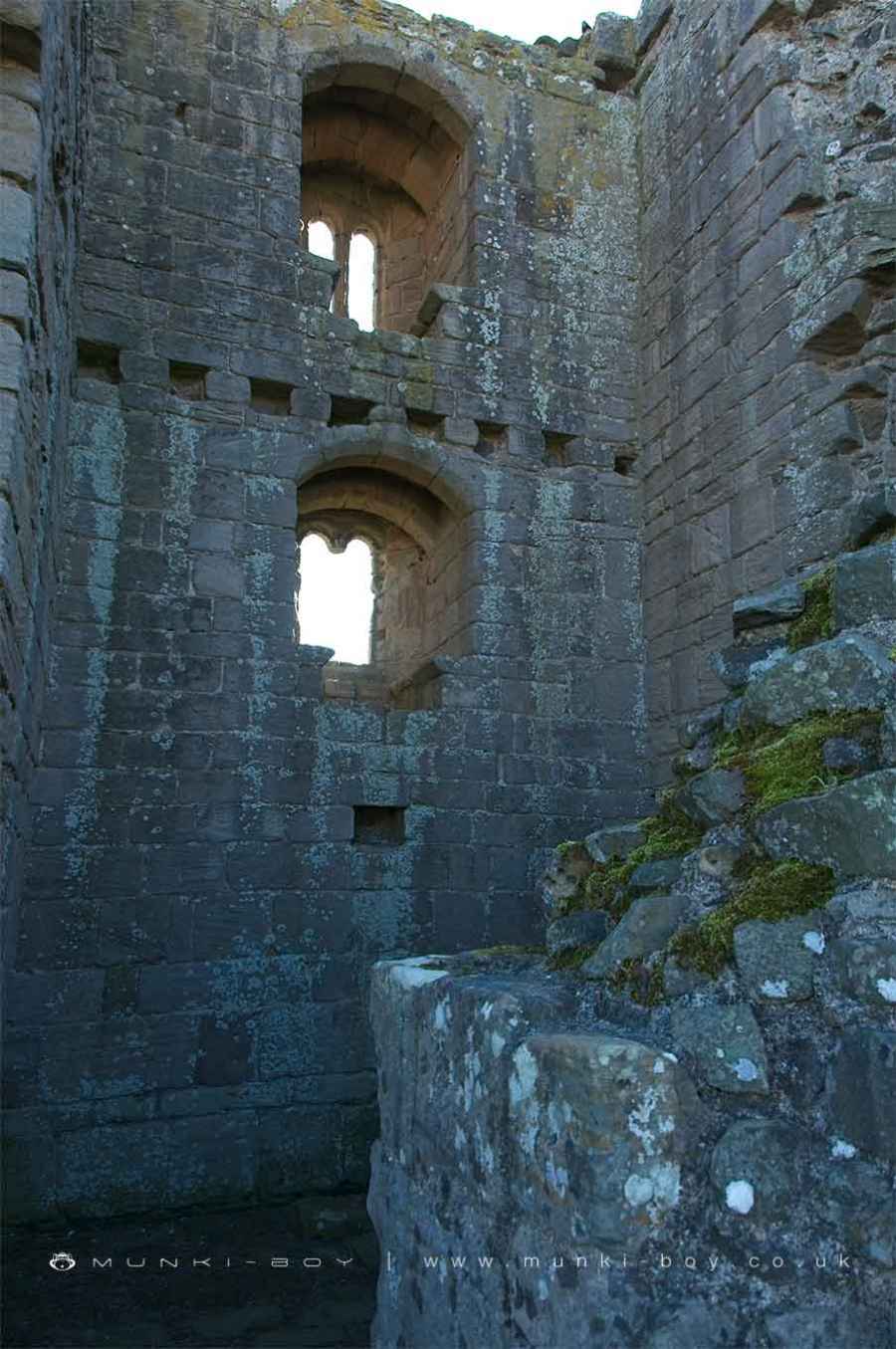
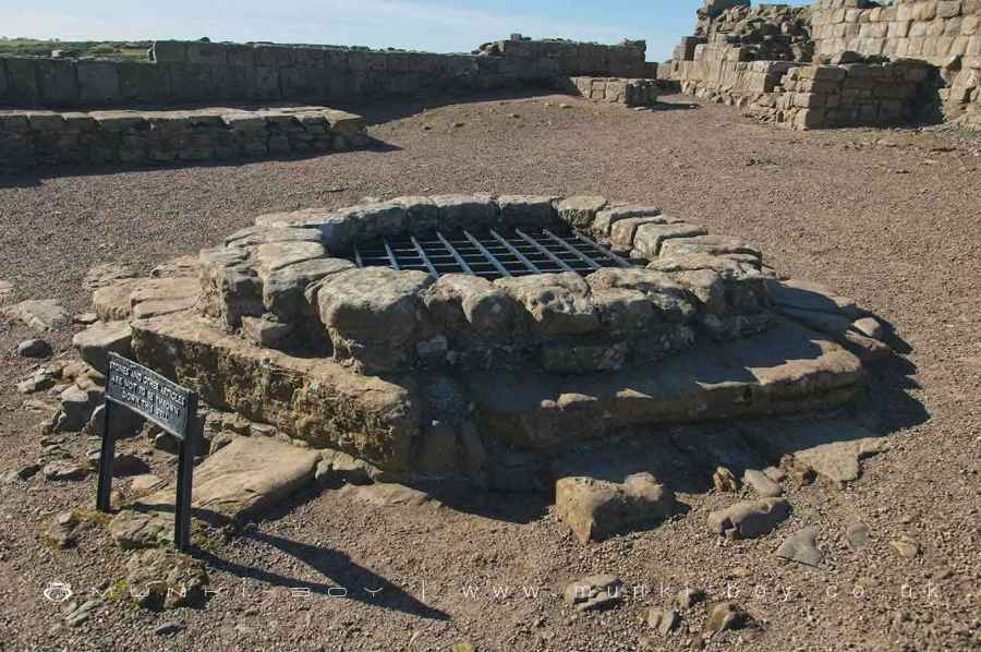
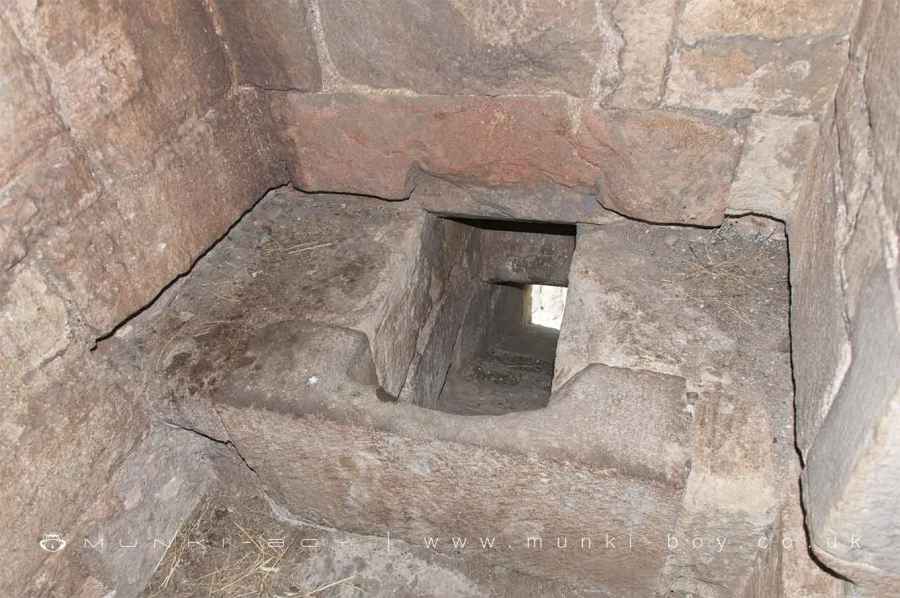
The monument occupies an isolated basalt promontory overlooking the North Sea and includes the sites of a second century Romano-British settlement, a 14th century enclosure castle with associated outworks and a harbour, and a World War II pillbox and foxhole. Evidence for Roman occupation was found during partial excavations carried out within the castle in 1930 and 1931 when fragments of imported Rhenish millstones were found in addition to sherds of samian pottery. Although the precise nature of the occupation is not yet fully understood, the site is a likely setting for a small fort or signal station since the Roman frontier, during the second half of the second century AD, ran from the Forth to the Clyde. The enclosure castle was begun in 1313 and work on its walls and gatehouse appears to have been complete by 1316 when Edward II made its construction legitimate by granting licence to crenellate. The gatehouse, which became the keep of the later castle, comprises two D-shaped drum towers separated by a rib-vaulted gate-passage. A barbican or outer defence was built to guard the front entrance, but this was largely removed during alterations carried out in the later 14th century. The semicircular fronts of the towers were originally five-storeys high, projecting two storeys above the main part of the building. Each of the towers carried a corbelled stair turret which rose above the gate- passage and provided access to the upper levels of the tower. Other turrets occupied the north-facing corners of the gatehouse and could be reached from the wall-walk which extended round the curtain wall of the castle. Guardrooms containing fireplaces and a garderobe or privy occupied the ground floors of each tower, while small chambers were built into the thickness of the curving walls and have been interpreted as porters’ lodges. The first floor of the gatehouse comprises numerous chambers including one, set above the gate- passage, which originally contained the winding gear for a portcullis and also murder holes (narrow, slanting shafts through which projectiles could be aimed at attackers below). The second floor contained the lord’s hall, which was divided from his solar or private chambers by wooden partitions. Between 1372 and 1383, the gate-passage was blocked at either end and the gatehouse ceased to function as an entrance and instead became the keep. A new gate-tower was built in the west curtain and was protected by a barbican to which a mantlet or screen wall was later added. This wall ended in a second gateway which adjoined the south west tower of the keep. In 1382-83, an inner ward was created behind the keep by the construction of narrow building ranges round a small courtyard. Along with a tower at the north east corner, these will have included accommodation for guests and men-at-arms in addition to the main service buildings of the castle. A large oven indicates that the north range included a bakehouse while the west range contained a kitchen. The inner ward, keep and gate occupy the south west angle of a much larger enclosure bounded on all four sides by curtain walls and containing the remains of further defensive and domestic structures. The latter include the buried and earthwork remains of the castle’s home farm. This is recorded as having an oak barn built in 1454 and last repaired in 1470. Other buildings of the farm complex appear to have been stone constructions. Only the west, south and east curtain walls are upstanding, the north curtain having been greatly damaged by the action of the sea as early as 1543. In addition to the gate-tower, included in the west curtain is the Lilburn Tower. This was built in c.1325 for John Lilburn, constable of Dunstanburgh, and is a three-storey building with tall corner turrets projecting above its flat roof. Each floor included a single apartment, all with fireplaces and the upper two with projecting garderobes. At first floor level, a passage is contained within the thickness of the east wall, allowing direct access between the wall walks on the north and south sides. A postern or secondary gate also lies to the north. Two further towers exist in the south curtain. The first, built overlooking a narrow inlet at the junction of the south and east curtain walls, is Egyncleugh Tower. This tower dates from the same period as the Lilburn Tower and has opposing gateways at back and front, showing it to have been the water gate referred to in a document of 1386. A drawbridge crossed the rock cut moat to the south and was protected at its outer end by a barbican or similar structure depicted in a drawing of 1678. Above the gate were two floors containing single apartments, each with a fireplace and garderobe. To the west, approximately midway along the south curtain, is the Constable’s Tower, built in the later 14th century at the south east corner of a courtyard which formed the middle ward of the later castle. This three-storey tower also contained apartments on its upper floors, each with south-facing windows furnished with window-seats. A small group of buildings attached to the north east corner of the tower have been interpreted as the constable’s hall, chambers and offices, while building foundations along the north side of the middle ward indicate the positions of ancillary buildings such as kitchens and workshops. The remaining east curtain, built above the steep 30m cliff, originally consisted of a flat-topped earthwork faced with stone. Into this were inserted three garderobe chambers for the men-at-arms patrolling the wall walk. In the 15th century, a wall was constructed on top of the earthwork. Approximately 500m south of the castle, north west of the inlet called Nova Scotia, is an area formerly occupied by the castle harbour. In 1314, a ditch was dug from the harbour to Embleton Bay, north of the castle. This ditch, which measures c.4m deep and 24m wide, made the castle and the area lying between it and the harbour into an island, and access was via a drawbridge across the ditch. A World War II pillbox and foxhole lie just north of where the ditch and harbour joined. The area enclosed by the ditch is crossed, predominantly from east to west, by the earthwork remains of post-medieval ridge and furrow beneath which, in 1949, building foundations of possible medieval date were found. In addition, c.50m south of the castle keep, are the earthwork remains of a roughly square enclosure flanked to the north by the foundations of a range of buildings forming two sides of a courtyard. These remains have been interpreted as an outwork commanding the approach to the castle but may, alternatively, be the site of a later farmstead. Ridge and furrow crosses the enclosure, but it has not been determined which is the later feature. From early in the Norman period, Dunstanburgh was part of the barony of Embleton but no castle was built there until Thomas Earl of Lancaster, High Steward of England, ordered its construction in 1313. Unusually for the area and the time, the castle was not built to defend the Scottish Marches nor was it the centre of the baronial fee. It appears to have been intended as a bolt-hole for Lancaster who spent most of his life in opposition to King Edward II and his favourites, even to the point of unlawfully executing Piers Gaveston. It did not serve him, however, and he himself was executed in 1322 after the battle of Boroughbridge. For four years, the castle continued under its constables, providing horsemen for the army that invaded Scotland in 1322 and, in 1326, ships to protect the king against Queen Isabella. In the same year the castle was returned to the heirs of Earl Thomas and, in 1362, was succeeded to by John of Gaunt who, in the 1380s, in response to Scottish raids, ordered the repairs and alterations that were made to the castle at that time. John of Gaunt died in 1399 and was succeeded by his son, Henry Bolingbroke who, in the same year, usurped the throne of Richard II to become King Henry IV. In this way Dunstanburgh became a royal castle governed by constables and appears to have been allowed to decay. However, annual expenditure reports made to the Duchy of Lancaster from 1436, show that large scale repairs were being carried out in the years leading up to the Wars of the Roses when, but for a brief period in 1462, Dunstanburgh remained a Lancastrian stronghold. It was finally taken in 1464 in a Yorkist victory that, together with those at the recent battles of Hedgeley Moor and Hexham, ended the Lancastrian cause in the north. From that time it fell into ruin and, in 1604, was sold by the Crown. In 1885, the original gate-passage through the keep was reopened and the gate arch that can be seen today was added to the front. The castle has been in state care since 1930 and is a Grade I Listed Building. Excluded from the scheduling are all English Heritage and National Trust fittings and fixtures, all modern fencing and all gates and stiles, and the wreck of the Polish trawler located below the high water mark south of the medieval harbour, but the ground beneath these features is included.
Sources
Books and journals Hunter Blair, C H , Dunstanburgh Castle, (1936) Summerson, H, Dunstanburgh Castle, (1992) ‘Archaeologia Aeliana’ in Archaeologia Aeliana, , Vol. 13, (1936), 279-92 Cramp, R, ‘BAR Brit Ser’ in Settlement In North Britain 1000BC-AD1000, , Vol. 118, (1983), 263-298 Other NT monument numbers 302 and 367, National Trust Regional Office Northumberland, Features of Archaeological Interest - Dunstanburgh Castle Area,
[Scheduled Monument Listing]
Dunstanburgh Castle is in Northumberland Coast AONB, a designated Area of Outstanding Natural Beauty.
Created: 8 March 2021 Edited: 29 November 2023
Dunstanburgh Castle Information
Dunstanburgh Castle Address
Dunstanburgh Rd, Alnwick NE66 3TT, UK
NE66 3TT
Website: http://www.nationaltrust.org.uk/dunstanburgh-castle/
Get directionsDunstanburgh Castle LiDAR Map

Contains public sector information licensed under the Open Government Licence v3.0
Local History around Dunstanburgh Castle
There are some historic monuments around including:
Dovecote S of Glebe FarmCraster defended settlementDeserted medieval village and chapel at TughallSt Ebba's chapel and monastic siteBenthall round cairnDunstanburgh Castle: Romano-British settlement, 14th century enclosure castle and harbour, and World War II pillbox and foxholeDefended settlement, 600m south east of Red Stead.


