Dover Castle
Dover Castle
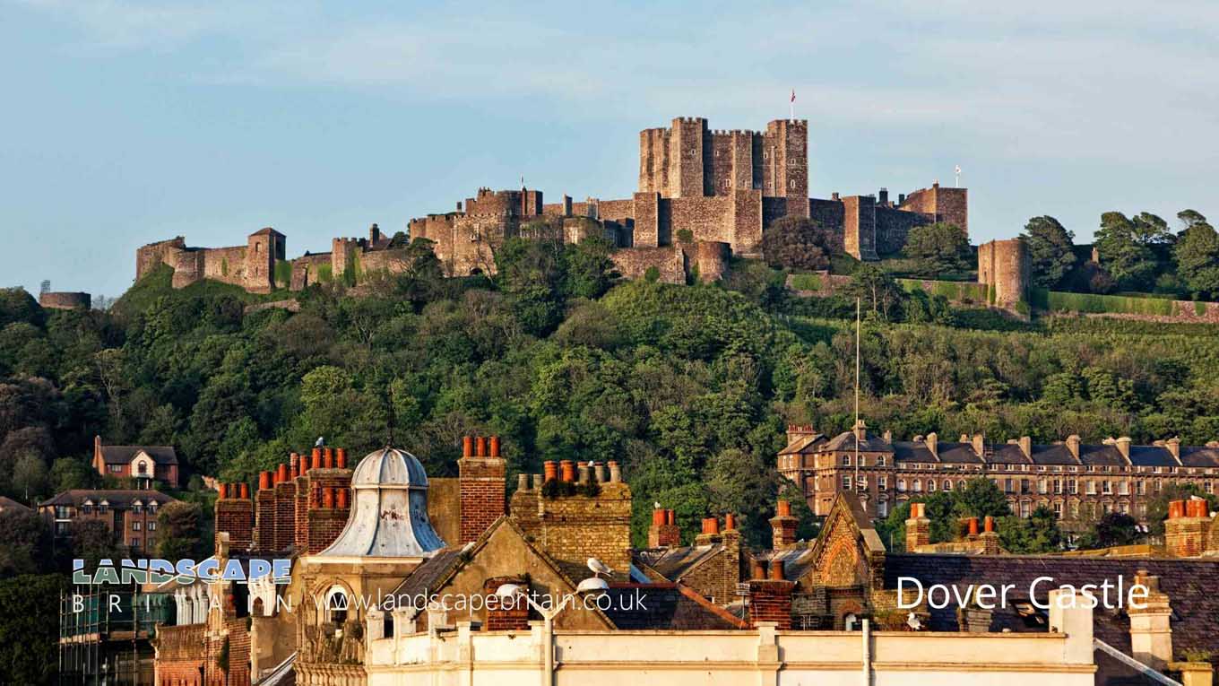
Dover Castle overlooks the town of Dover, Kent. It is located on top of a cliff just off the coast which was once home to a Roman lighthouse. In fact Dover takes its name from this very cliff as Dover means ‘a Cattle Ford’ due to its location between two cliffs.
The Romans built their fortifications out of wood and it is thought that they used Dover Castle as one of the coastal defences against other invaders from across the English Channel, but there has been no evidence found to prove this idea. The first real description we have for Dover castle comes from William of Poitiers who described the stronghold in 1066 when William I conquered England. William II then improved upon Dover castle with stone walls and towers and Dover went on to become one of the most important castles in medieval times. Dover also witnessed a number of key historical events such as the signing of treaties between Kings and Archbishops, sieges and skirmishes. Dover was not only used as a gateway for English troops to attack France but it was also the place where troops returned after their battles along the French coast.
During World War II Dover Castle acted as an anti-aircraft station and it was chosen as one of several sites that comprised Britain’s coast artillery defence against German attack during World War II. Dover castle is now managed by English Heritage.
Created: 30 October 2021 Edited: 29 November 2023
Dover Castle Information
Dover Castle Address
Castle Hill Rd, Dover CT16 1HU, UK
CT16 1HU
Website: http://www.english-heritage.org.uk/visit/places/dover-castle/
Get directionsDover Castle LiDAR Map

Contains public sector information licensed under the Open Government Licence v3.0
Local History around Dover Castle
There are some historic monuments around including:
Fort BurgoynePremonstratensian monastery and associated fishponds at West LangdonFortifications, Roman lighthouse and medieval chapel on Western HeightsBowl barrow 530m north of Langdon AbbeyMaison DieuSt Nicholas' Church, OxneyThe Bath House, N of Market StreetSouth-western section of the Roman Fort of the Classis Britannica, near Albany PlaceSt Martin's ChurchA pair of acoustic mirrors at Fan BayAdmiralty Pier Turret 636m south east of Lord Warden HouseSt Martin's Priory (remains of)A Springfield style enclosure, a group of associated prehistoric pits and ditches and an oval barrow 1km NNE of Langdon AbbeyFairburn-type crane, Wellington DockDover CastleTwo bowl barrows on Free Down, 550m south of Hill FarmThe Painted House, N of Market StreetArchcliffe FortSt James' ChurchSaxon shore fort bastion, Queen Street.


