Clearwell Caves by munki-boy
Clearwell Caves
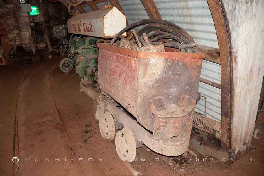
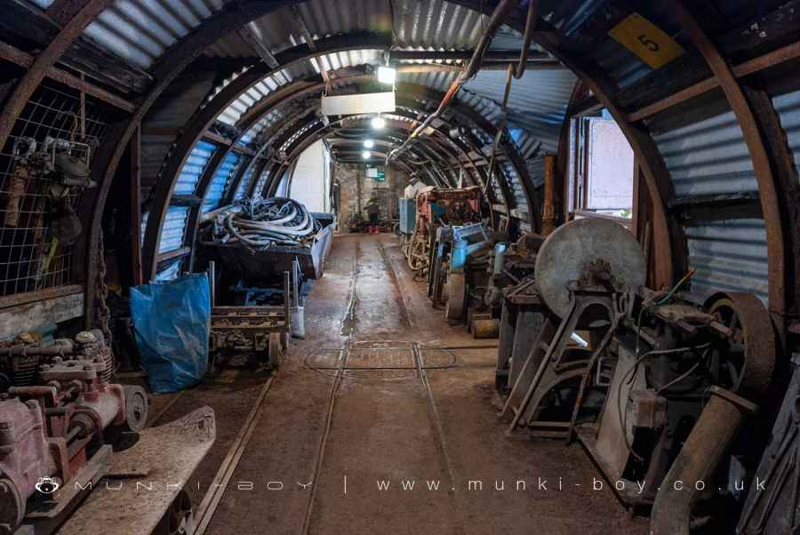
The nine caverns open to the public at Clearwell are part of a mine complex extending over 245 hectares (600 acres).
The cave system consisting of thousands of caverns and over 30km (20 miles) of passageways, throughout the limestone strata which dips from west to east at an angle of 15 degrees.
The old mines extended down to 135 m (530 ft) below the surface but since deep mining and water pumping ceased in 1945 the water table has returned to its normal variable level of around 110-120 m (350-400 ft).
Created: 1 August 2021 Edited: 29 November 2023
Clearwell Caves Information
Clearwell Caves Address
The Rocks, Clearwell, Coleford
GL16 8JR
Website: http://www.clearwellcaves.com/
Get directionsClearwell Caves LiDAR Map

Contains public sector information licensed under the Open Government Licence v3.0
Local History around Clearwell Caves
There are some historic monuments around including:
Clearwater Paper Mill Offa's Dyke: section in Church Grove, 240m south west of Ferney LeazeMotte Castle 57m south-west of Church of St Mary MagdaleneOffa's Dyke: section in Mocking Hazell Wood, 400m south of Lindors FarmStaunton crossCamp Hill promontory fort and Romano-British temple complexDark Hill iron works and brickworks complex and Bear 220m south and 200m south east of Yew Tree CottageOffa's Dyke: section 470m west of Wyegate BarnRoman Villa at Clearwell FarmOffa's Dyke: section immediately south of Coxbury FarmVillage cross at AylburtonEarly Iron Furnace at Coed-Ithel Offa's Dyke: section on St Briavels Common, 90m north of The CherriesCross in All Saints' churchyardMerlin's Cave, Great DowardOffa's Dyke: section on Madgett Hill, 580m west of The Old MillOffa's Dyke: section at Birchfield CottageScowles in Blake's Wood 870m north west of Scowles FarmOffa's Dyke: section on St Briavels Common, 400m east of Yewgreen FarmOffa's Dyke: section on St Briavels Common, 100m south east of Hill FarmOffa's Dyke: section in Highbury Plains, 370m west of Birt's BarnOffa's Dyke: section in Cutt's Orchard, 230m south east of Brook HouseCamp NE of StoweRedbrook Incline Overbridge Whitecliff Iron WorksSt Briavel's CastleOffa's Dyke: section on Madgett Hill, 290m south east of Brook HouseScowles in the north of Blake's Wood 620m south east of Church FarmOffa's Dyke: section in St Margaret's Grove, 170m north east of Gumbers Land BarnMotte and bailey castle at English BicknorOffa's Dyke: section in Victuals Grove, 230m north of Beaconsfield CottageOffa's Dyke: section on St Briavels Common, 220m east of Upfield HouseScowles in Dingle Wood 560m north west of Scowles FarmWhitebrook Wireworks Leat Tower keep castle on Little Camp HillVillage cross at ClearwellOffa's Dyke: section on St Briavels Common, 230m north of Hudnalls FarmSite of Wireworks at Whitebrook Offa's Dyke: section in Highbury Plains, 770m south west of Glyn FarmTitanic Steel Works 230m south west of Yew Tree CottageOffa's Dyke: section on St Briavels Common, 190m west of Hudnalls FarmSymonds Yat promontory fortOffa's Dyke: section on Madgett Hill, 380m south east of Brook HouseOffa's Dyke: section 65m north of Brook HouseOffa's Dyke: section in Highbury Wood, 460m west of Glyn FarmOffa's Dyke: section 340m south east of Coxbury FarmOffa's Dyke: section immediately north west of Coxbury FarmOffa's Dyke: section on St Briavels Common, immediately south of SittingreenOffa's Dyke: section on St Briavels Common, immediately west of The FieldsOffa's Dyke: section in Wyeseal Wood, 600m north of Gumbers Land BarnKing Arthur's Cave, Great DowardLittle Hadnock Roman Villa, Dixton Newtown .


