Church of St Peter Askham by munki-boy
Church of St Peter Askham
Church of St Peter Askham is in The Lake District National Park in England.
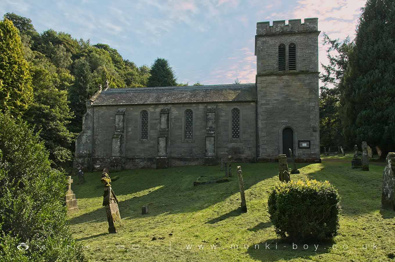
GV II Parish church. Dated over entrance 1832, by Sir Robert Smirke (who was also the architect of the nearby Lowther Castle), incorporating features from the medieval church on this site. Snecked calciferous sandstone ashlar with eaves cornice and raised quoins, on chamfered plinth. Graduated green slate roof with coped gables and cross finials. Square south-west tower, 4-bay nave/chancel with north transept and south aisle. Tower has round-arched studded south door, round-headed windows and round-headed twin bell openings. Nave has west studded doors in pointed arch under 3-light window. Each side has round-headed windows. 3-light east window. Interior has 4-bay Gothic-arched arcade. Rear gallery, panelled pulpit and C19 panelled oak pews, the ends carved with Lowther arms. Various C19 white marble wall plaques. Transept was the burial chapel of the Sandford family of Askham Hall, hence C17 and C18 wall plaques to members of that family. Stem and bowl font dated 1661. C19 creed and pater boards.
Created: 26 October 2020 Edited: 29 November 2023
Church of St Peter Askham
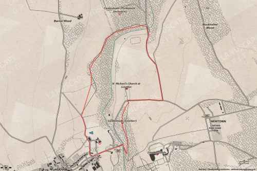
Walks in Church of St Peter Askham
Local History around Church of St Peter Askham
There are some historic monuments around including:
The Cockpit stone circle and seven adjacent clearance cairns, Moor DivockBrougham Roman fort (Brocavum) and civil settlement and Brougham CastleRound cairn 280m south-east of The Cockpit stone circleLinear stone bank on Askham FellEamont BridgeRound cairn west of enclosure on Four Stones HillStrickland's Pele Tower and Penrith CastleSettlement 100yds (90m) SE of Sceugh FarmTwo round cairns 415m and 420m NNE of The Cockpit, Moor DivockRound cairn 660m north east of The Cockpit, Askham FellBowl barrow 80m east of Scarside PlantationThe Giant's Thumb - Anglian high cross in St Andrew's churchyard, PenrithTwo standing stones and a round cairn south of CrooklandsFour funerary cairns and a surrounding cairnfield on Threepow RaiseRound cairn 50m north east of White Raise round cairn, Askham FellRing cairn on Askham Fell including The Cop StoneBowl barrow 350m north east of The WreayRing cairn on Knipescar CommonRound barrow 150m east of Scarside PlantationRound cairn north of Four Stones HillSewborrans standing stone 400m south west of SewborwensLong cairn 330m east of MossthornRound cairn 490m ENE of Rough Hill TarnMoated site east of Newton ReignyRound cairn on Askham Fell, 335m north of the Cop StoneRound cairn 680m ENE of DalefootKing Arthur's Round Table hengeRound cairn 490m south east of White Raise round cairn, Askham FellRound cairn 475m south east of White Raise round cairn, Askham FellRing cairn on Askham Fell and four adjacent stonesMayburgh hengeMelkinthorpe medieval settlement, part of its associated open field system and the site of Melkinthorpe HallSt Ninian's preconquest monastic site, site of nucleated medieval settlement, St Ninian's Church and churchyardThe Giant's Grave - Two Anglian cross-shafts and four hogback stones in St Andrew's churchyard, PenrithSettlement 1/3 mile (540m) ENE of Brougham CastleRoman marching camp 450yds (410m) NE of BrovacumRound cairn on Heughscar HillRound cairn on Askham Fell, 270m north of The Cop StoneLittle Round Table hengeRoman road and enclosures SE of FrenchfieldBridge over Heltondale Beck 250yds (230m) SSW of WidewathRound cairn on Burn BanksRomano-British settlement and regular aggregate field system north of Yanwath WoodMoated site and annexe east of Setterahpark WoodRound cairn 285m south east of White Raise round cairn, Askham FellThe Old Kiln, Wetheriggs PotteryRound cairn 515m south east of White Raise round cairn, Askham FellClifton Hall towerLong cairn 370m ESE of Mossthorn FarmBowl barrow 850m WSW of Yanwath Woodhouse FarmRing cairn east of Threepow RaiseBridge over Heltondale Beck 550ft (170m) S of WidewathTowtop Kirk early Christian enclosureCastlesteads multivallate prehistoric defended enclosureWhite Raise round cairn, Askham FellStanding stone 180m NNE of SkirsgillRound cairn west of Riddingleys Top, Askham FellThe Countess PillarTwo standing stones north-west of Four Stones HillSkirsgill Romano-British enclosed stone hut circle settlement, Romano-British farmstead, and Romano-British regular aggregate field systemRound cairn 580m north east of The Cockpit, Askham FellEnclosure containing four clearance cairns and a stone bank west of Four Stones HillStone circle 800m east of Wetheriggs PotteryAskham Fell stone alignmentRing cairn on Knipescar Common south of Inscar PlantationLong barrow on Trainford BrowRound cairn 520m north east of The Cockpit, Askham FellStone bridge, Cawdale BeckRomano-British settlement at Cragside WoodSlight univallate hillfort in Scarside Plantation.


