Basingill Gunpowder Works (ruin) by munki-boy
Basingill Gunpowder Works (ruin)
In 1790, Basingill Gunpowder Works was established to provide greater incorporating mills for the long-closed Old Sedgewick gunpowder factory a short distance upstream of Basingill.
The basingill gunpowder works are located on the River Kent at basingill, north west of Sedgwick. The works were established in 1790 just down stream from where Old Sedgewick gunpowder factory was closed during conversion to an incorporating mill for Basingill gunpowder works.
Until the mid-nineteenth century, gunpowder was the only incendiary available for military use and quarry blasting. From the mid-16th century, water-powered manufacturing mills were established in England, although powder had previously been prepared by hand for at least 200 years.
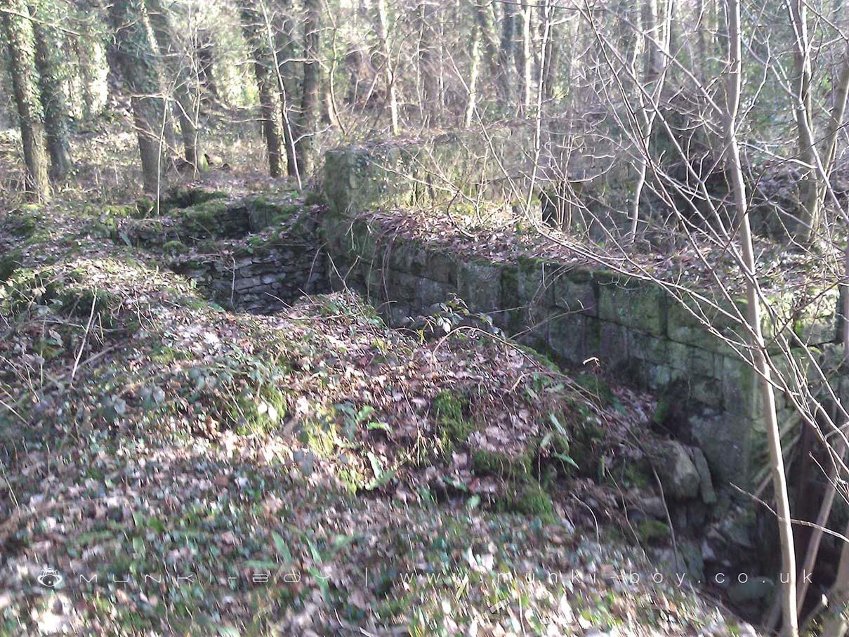
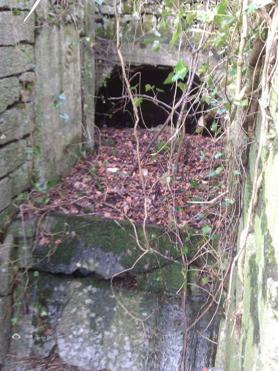
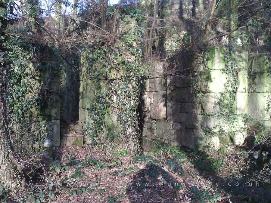
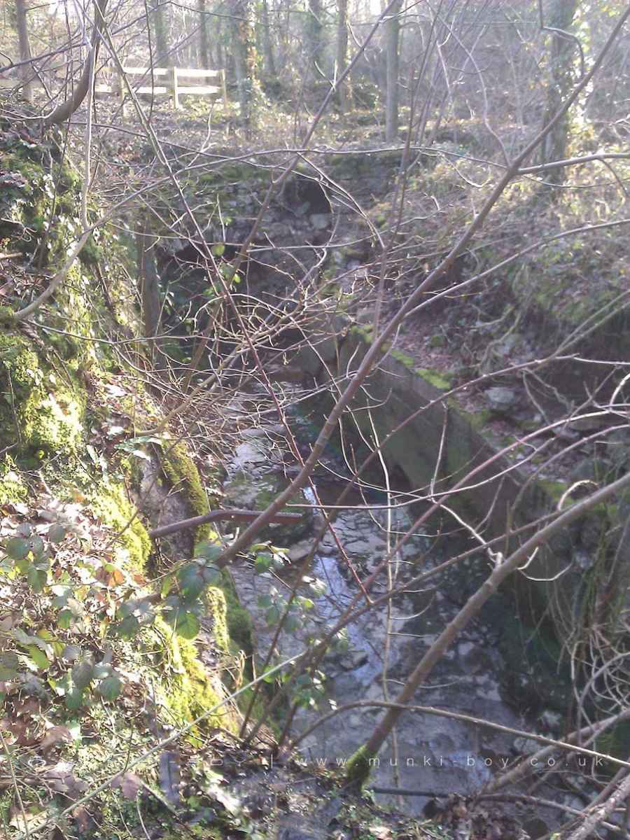
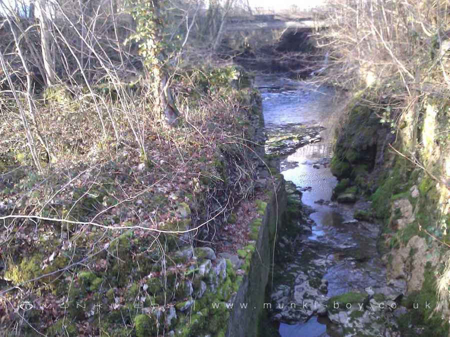
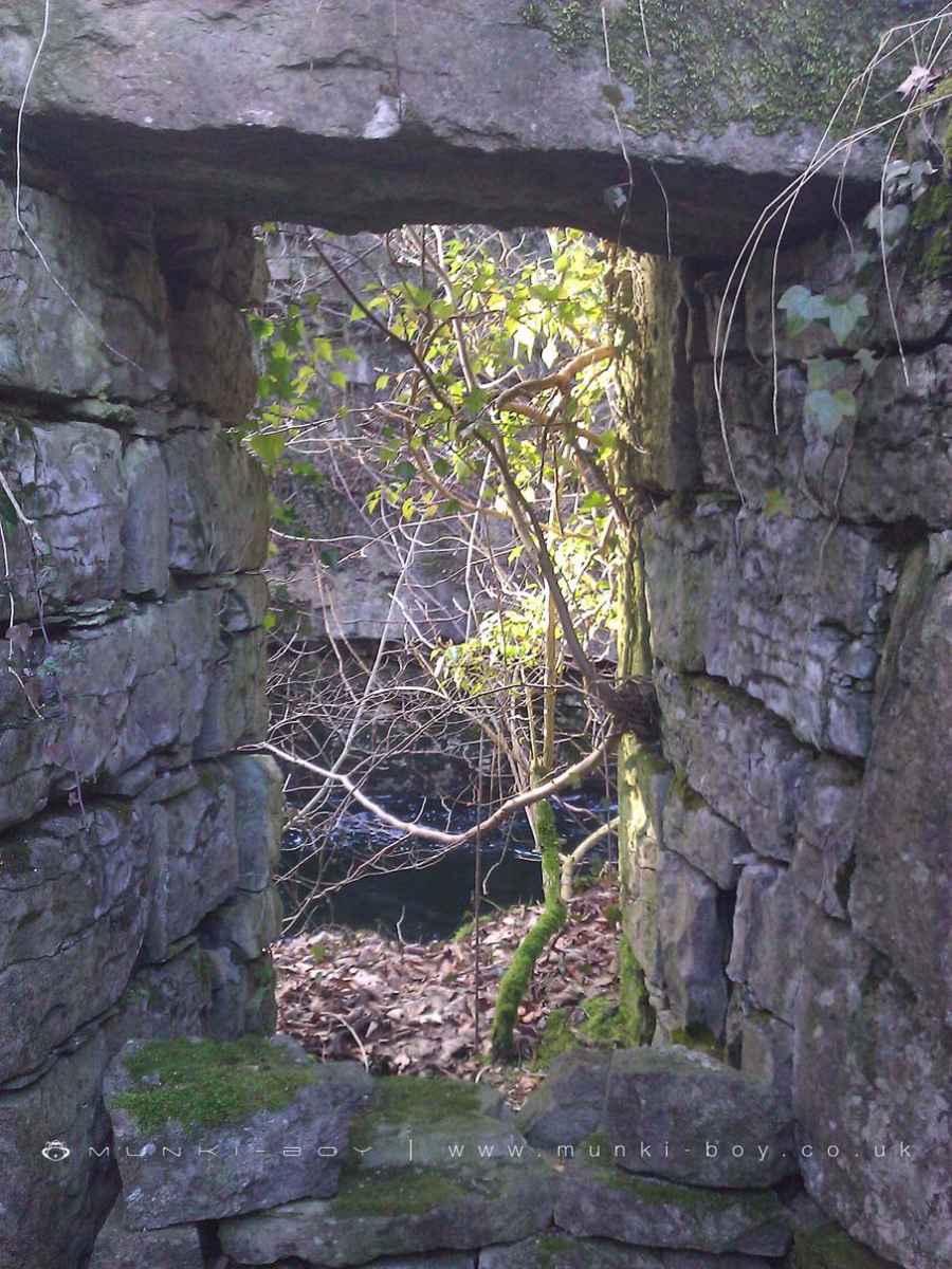
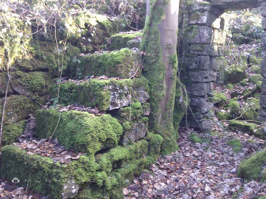
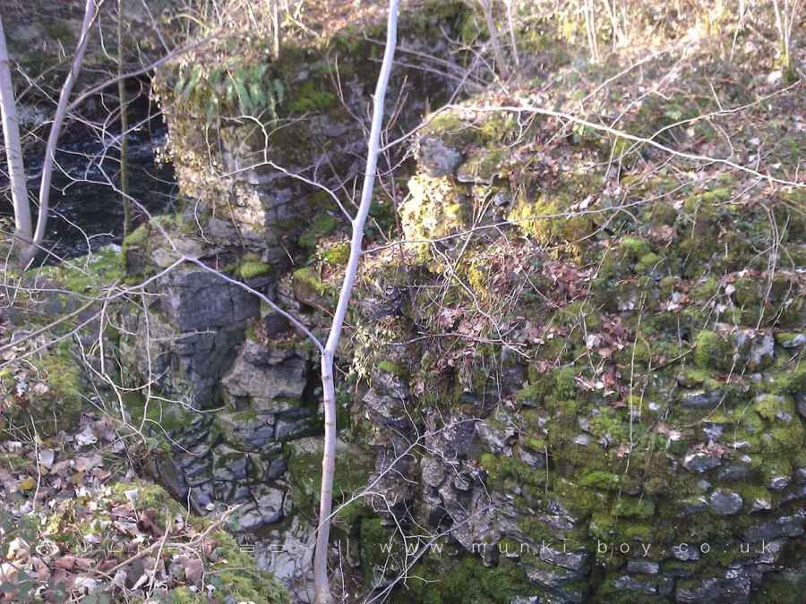
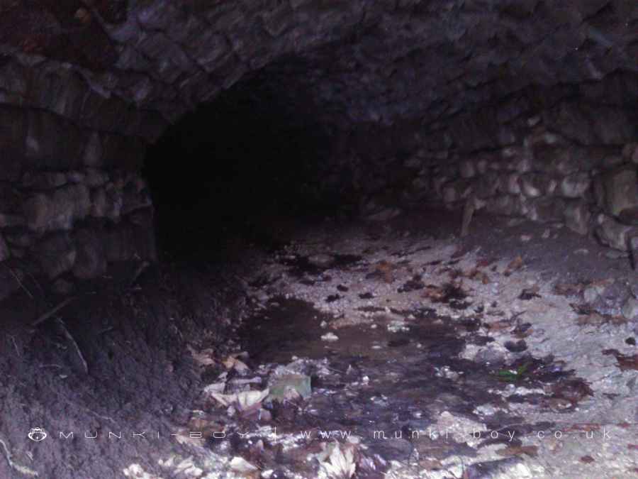
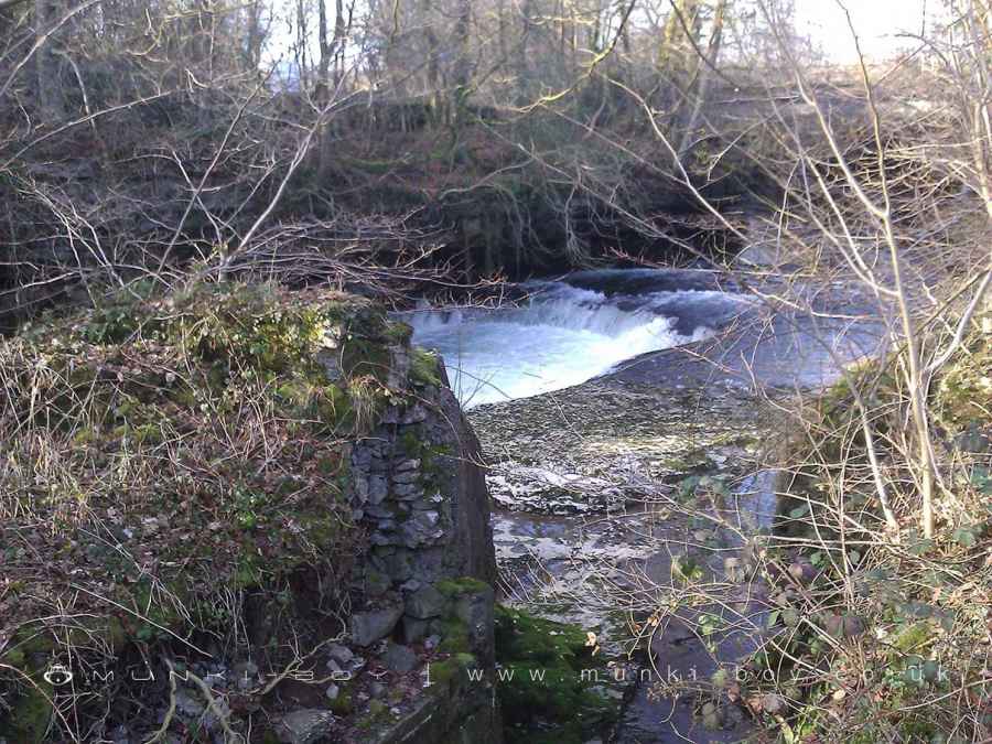
The ruins, earthworks, and buried remains of the Basingill Gunpowder Works, which were located on the east bank of the River Kent approximately 700m WSW of Sedgwick village.
The remains include three sets of integrating mills with architectural features, as well as a little amount of original timberwork, the water management system built to provide power for driving the machinery in these mills, a green charge house and watch station sites, and the ruins of a wrought charge house and watch house.
The name Basingill comes from the nearby waterfall named Basin Ghyll.
Created: 12 November 2021 Edited: 29 November 2023
Basingill Gunpowder Works (ruin)
Kent - confluence with Sprint to tidal Details
Kent - confluence with Sprint to tidal
Kent - confluence with Sprint to tidal is a river in Cumbria
Kent - confluence with Sprint to tidal takes in water from an area around 51.932 km2 in size and is part of the Kent catchment area.
Kent - confluence with Sprint to tidal is 20.922 km long and is not designated artificial or heavily modified.
Basingill Gunpowder Works (ruin) LiDAR Map

Contains public sector information licensed under the Open Government Licence v3.0
Local History around Basingill Gunpowder Works (ruin)
There are some historic monuments around including:
Sedgwick aqueductRingwork in Dallam Park 380m south east of Dallam TowerRound cairn 230m north of Berry HolmeLow Gatebeck gunpowder works, 540m south west of Gatebeck FarmStramongate BridgeWatercrook Roman fort and civil settlementBasingill gunpowder works, 130m south of Force BridgeCastle Howe motte and baileyPart of Helsington medieval village immediately west of Briggs House FarmHincaster Tunnel horse pathMiller BridgeCappleside Hall medieval lordly residence 600m north east of Beetham HouseCastlesteads small multivallate hillfort on The HelmLevens BridgeSettlement 440yds (400m) N of Cunswick HallPackhorse bridge at the Post OfficeEarthwork 700yds (640m) N of Levens BridgeBeetham Hall (curtain wall and uninhabited portion)New Sedgwick gunpowder works, 580m north of Gate HouseGreenside lime kiln 480m west of Castle HoweNether BridgeKendal Castle and associated earthworks, and earlier ringworkLevens Park, round barrows and medieval settlements, including Temple of Diana.


