Aspull Sough by munki-boy
Aspull Sough
The Haigh Sough was driven into the rock to reach mines on the local King, and Cannel coal seams in 1657 by Sir Roger Brandshaigh to provide drainage. The sough was later extended eastward in the 19th Century.
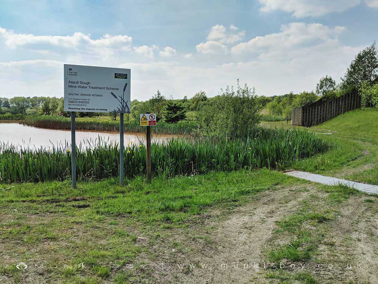
The old sough is now tapped into a modern pipeline and onto an aeration cascade (behind the wooden fence in the photograph), before filtering.
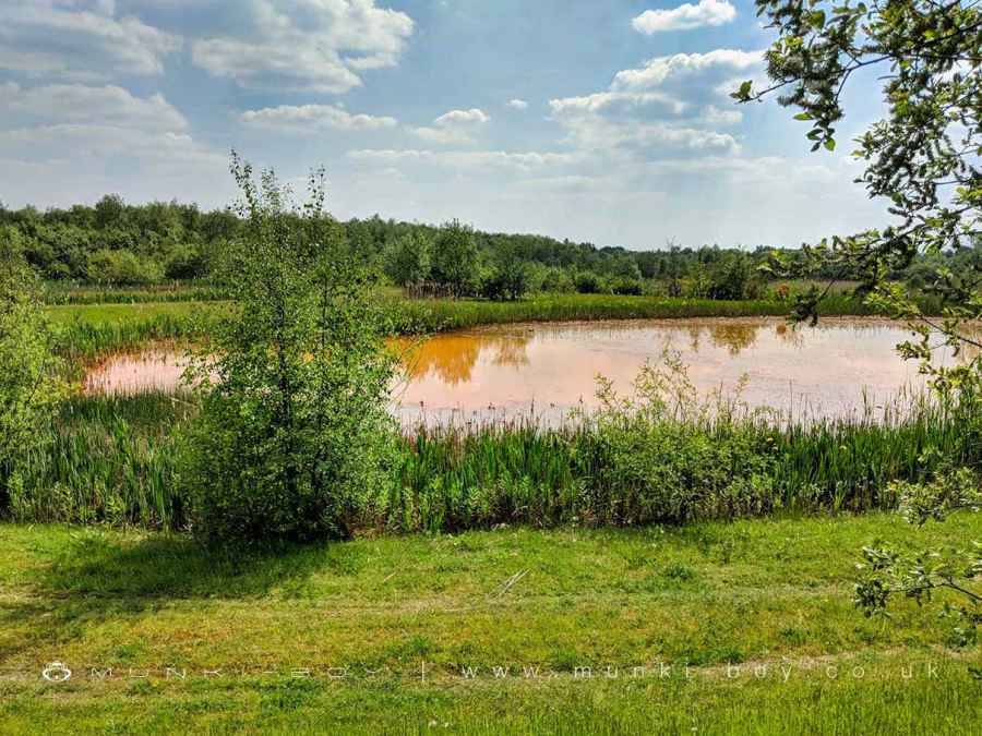
Since mine working stopped in the area in the last century the old mine workings have been flooded, causing minerals from the rocks to dissolve into the water that leaks out of the mines and into local rivers, lakes and streams. Although the minerals are naturally occurring, they would only slowly leach out of the rock over many thousands of years. Blasting and tunneling of local mines and quarries together with subsequent flooding causes minerals to dissolve into the water relatively quickly - which is a problem for the local environment.
A particularly noticeable mineral contamination in the local area is iron pyrite, often seen as a bright orange “rust” in the water - in fact the nearby stream is known as the Yellow Brook. This high-concentration of iron in the water smothers plant and animal life in the water - which in-turn starves other animals up the food chain.
Aspull Sough Mine Water Treatment Scheme
In 2003 a water treatment scheme was constructed in which water from the old Haigh Sough is passed through three bright-orange ponds before passing through reed beds which filter out the iron content from the water. The ponds, reed beds and surrounding planting areas provide a wildlife refuge, while keeping the public away from direct contamination.
Water from the sough is finally discharged over a small artificial cascade and into the Yellow Brook, the water here looks incredibly clear and various aquatic plants can be seen in the brook. Not far downstream the Yellow Brook goes over the well-known cascade and into the River Douglas in the Haigh Lower Plantations. Near the outflow from the water treatment area a little iron ochre staining can still be seen.
The whole area around the sough is inaccessible to the public, although the reed beds are viewable from the footpath on the lower side.
Created: 22 September 2019 Edited: 29 November 2023
Aspull Sough
Aspull Sough LiDAR Map

Contains public sector information licensed under the Open Government Licence v3.0
Local History around Aspull Sough
There are some historic monuments around including:
The Moat House moated site 600m WNW of St David's ChurchGidlow Hall moated site, Aspull, 560m NNE of Pennington HallMabs Cross on Standishgate, 20m west of Mabs Cross School buildingHaigh Sough mine drainage portal, 310m west of Park HouseCross base at the junction of Standish Green Lane, Standish Wood Lane and Beech Walk, 200m NNW of Strickland House Farm, StandishCross base on Green Lane 300m north of Strickland House Farm, StandishHeadless Cross, GrimefordMarket cross in the marketplace to the west of St Wilfrid's Church, StandishMoated site at Arley Hall, Haigh near WiganCross base on Standish Wood Lane 700m south east of Standish Hall.