Bonnybridge
Bonnybridge is a Town in the county of Stirling.
There are great places to visit near Bonnybridge including some great cities and historic monuments.
Stirling is a great place to visit close to Bonnybridge if you like cities.
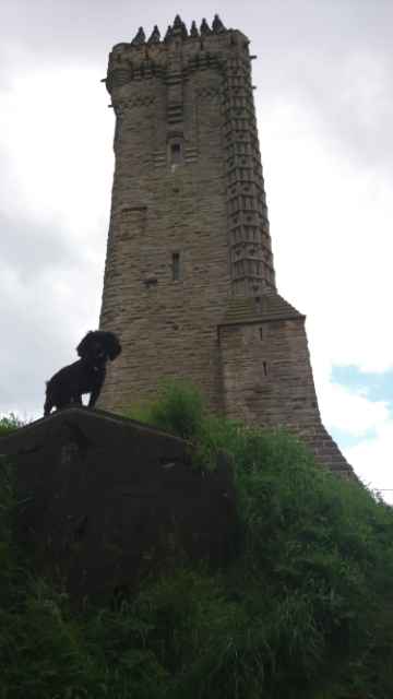
The area around Bonnybridge's best historic monuments can be found at Wallace Monument.
Bonnybridge History
There are some historic monuments around Bonnybridge:
- Antonine Wall, Rough Castle fort, annexe and Military Way Roman: Antonine Wall SM90013
- Antonine Wall, Seabegs Wood, rampart, ditch and Military Way Roman: Antonine Wall SM90014
- Antonine Wall, 160m ENE to 155m NW of St Joseph's Church Roman: Antonine Wall SM12606
- Wester Carmuirs, ring ditch 500m NW of Carmuirs West Junction Prehistoric domestic and defensive: house SM6415
- Gillies Hill,fort Prehistoric domestic and defensive: fort (includes hill and promontory fort) SM2566
- Braes,fort 130m WNW of Prehistoric domestic and defensive: fort (includes hill and promontory fort) SM456
- Carr's Hill,fort,Torwood Prehistoric domestic and defensive: fort (includes hill and promontory fort) SM1731
- Antonine Wall, W and E of Watling Lodge, Tamfourhill Roman: Antonine Wall SM90016
- Murrayshall Farm, dun 200m SE of Prehistoric domestic and defensive: dun SM7016
- Avonhead Colliery, miners' row Industrial: coal SM9677
- Camelon,Roman forts Roman: fort SM1746
- Antonine Wall, 80m SW of Woodhouse Eaves to Underwood Cottage Roman: Antonine Wall SM7739
- Wester Carmuirs, enclosures 50m E of Prehistoric domestic and defensive: palisaded enclosure SM6414
- Lochend Pit No. 5 and bing, 650m SW of Lochend Industrial: coal SM9680
- Antonine Wall, N of Cumbernauld airfield to Wyndford Road Roman: Antonine Wall SM90015
- Hill of Dunipace, motte & burial ground Ecclesiastical: burial ground, cemetery, graveyard; Secular: motte SM3420
- Castlecary House, souterrain 150m ESE of Prehistoric domestic and defensive: souterrain, earth-house SM6444
- Castleton,cup & ring marked rocks NW of Prehistoric ritual and funerary: cupmarks or cup-and-ring marks and similar rock art SM4381
- Plean Farm,palisaded enclosure 150m NE of Prehistoric domestic and defensive: palisaded enclosure SM6482
- Sauchinford Cottages,ring ditch 300m SSE of Prehistoric domestic and defensive: house SM6479
- Antonine Wall, Wyndford Road to Castlecary Roman: Antonine Wall SM90012
- Tor Wood,Roman road Roman: road SM2217
- Myot Hill,fort Prehistoric domestic and defensive: fort (includes hill and promontory fort) SM2381
- Antonine Wall and fort, Castlecary Roman: Antonine Wall SM90009
- West Plean Colliery No.3 Pit,coke ovens Industrial: coal SM4151
- Wester Carmuirs,Roman camp 640m SE of Roman: camp SM3188
- Wallstale,dun Prehistoric domestic and defensive: dun SM2110
- Antonine Wall, Watling Lodge fortlet, Tamfourhill, Falkirk Roman: Antonine Wall SM8453
- Plean Farm,ring ditch 800m SE of Prehistoric domestic and defensive: house SM6481
- Wester Craigend, dun 300m W of Prehistoric domestic and defensive: dun SM2121
- Forth and Clyde Canal: Auchinstarry Farm - Castlecary Industrial: inland water SM6766
- Antonine Wall, 495m WSW and 125m SE of Bonnyside House Roman: Antonine Wall SM8207
- Bruce's Castle Secular: castle SM2531
- Union Canal, River Avon to Greenbank Industrial: inland water SM8952
- Wallstale,limekilns 100m W of Industrial: kiln, furnace, oven SM3680
- Sauchinford Cottages, palisaded enclosure 100m ENE of Prehistoric domestic and defensive: palisaded enclosure SM6548
- Calderfield, enclosure 150m SW of Prehistoric domestic and defensive: enclosure (domestic or defensive) SM6543
- Thieves Hill, deserted settlement 400m E of Secular: settlement, including deserted, depopulated and townships SM9666
- Darnbogue, palisaded enclosure 200m SW of Prehistoric domestic and defensive: palisaded enclosure SM7018
- Househill,enclosure and part of Roman camp 250m SSW of Prehistoric domestic and defensive: enclosure (domestic or defensive); Roman: camp SM6483
- Hills of Dunipace, dovecote and remains of house 200m NE of Secular: doocote, dovecote, pigeon loft SM5378
- Easter Auchincloch,fort 180m NNE of Prehistoric domestic and defensive: cave SM2579
- Antonine Wall and fort, railway line to 300m E of Westerwood steading Roman: Antonine Wall SM90017
- Antonine Wall, Rough Castle to Lime Road, and field system Prehistoric domestic and defensive: field or field system; Roman: Antonine Wall SM8244
- Common Hill,homestead Prehistoric domestic and defensive: homestead SM1732
- Slamannan, motte Secular: motte SM1737
- Antonine Wall, 170m NNW to 305m NE of Falkirk High School Roman: Antonine Wall SM8828
- Wester Carmuirs, ring ditch settlement 450m SSW of Prehistoric domestic and defensive: house SM6413
- Plean Cottages,palisaded enclosure 350m SSE of Prehistoric domestic and defensive: palisaded enclosure SM6480
- Antonine Wall, 80m WSW of Seabegs Place Roman: Antonine Wall SM7744
- Antonine Wall, 300m NW of Milnquarter Roman: Antonine Wall SM12374
- Station House, Roman temporary camp 200m SE of Roman: Antonine Wall SM6542
- Antonine Wall, Lime Road to Tamfourhill Roman: Antonine Wall SM8251
- Avonhead Colliery Industrial: coal SM9675
- Antonine Wall, Milnquarter, Roman temporary camp 240m SE of Roman: Antonine Wall SM3242
- Doghillock, dun 700m N of Prehistoric domestic and defensive: dun SM6929
- Antonine Wall, 185m NNE of Castlecary House Hotel Roman: Antonine Wall SM11638
- Antonine Wall, Dalnair to Seabegs Wood, including fortlet and camp Roman: Antonine Wall SM7742
- Forth and Clyde Canal: Castlecary - M9 Motorway Industrial: inland water SM6768
- Torwood or Tappoch,broch Prehistoric domestic and defensive: broch SM1738
- Lochlands Roman camps Roman: camp SM4259
- Antonine Wall and motte, 75m SW of Antonine Primary School Roman: Antonine Wall; Secular: motte SM12373
- Gallamuir,enclosure 300m SE of Prehistoric domestic and defensive: enclosure (domestic or defensive) SM3948