Symington
Symington is a Village in the county of South Lanarkshire.
Symington postcode: ML12 6JY
There are great places to visit near Symington including some great towns and shopping centres.
Places near Symington feature a number of interesting towns including East Kilbride.
The area around Symington's best shopping centres can be found at EK - East Kilbride.
Symington History
There are some historic monuments around Symington:
- Tinto Cairn,cairn on summit of Tinto Hill Prehistoric ritual and funerary: cairn (type uncertain) SM4660
- Dungavel Hill,cairn Prehistoric ritual and funerary: cairn (type uncertain) SM4261
- Abington,motte & bailey 1600m N of Secular: bailey SM2609
- Cornhill,Roman camp N of Roman: camp SM5278
- Hillhead,earthwork 1220m NNW of Prehistoric domestic and defensive: enclosure (domestic or defensive) SM2652
- Hillend,enclosures 250m ENE of Prehistoric domestic and defensive: enclosure (domestic or defensive); Prehistoric ritual and funerary: henge SM5451
- Bizzyberry Hill,fort & Wallace's Well Prehistoric domestic and defensive: fort (includes hill and promontory fort); Secular: well SM2607
- White Hill, fort Prehistoric domestic and defensive: fort (includes hill and promontory fort) SM2743
- Cold Chapel,settlement 500m NE of Prehistoric domestic and defensive: settlement SM4530
- St John's Kirk,fort 360m WNW of Prehistoric domestic and defensive: fort (includes hill and promontory fort) SM2634
- Castle Hill,earthwork 820m SW of Prehistoric domestic and defensive: enclosure (domestic or defensive) SM2741
- Castle Dykes,earthwork,Roberton Prehistoric domestic and defensive: enclosure (domestic or defensive) SM2596
- Snaip Hill,fort Prehistoric domestic and defensive: fort (includes hill and promontory fort) SM2648
- Ewe Hill,barrows 750m NE of Biggarshiels Farm Prehistoric ritual and funerary: barrow SM4645
- Covington,castle & dovecot Secular: castle SM2599
- Shaw Hill,cultivation terraces 450m NE of Coulter Shaw Prehistoric domestic and defensive: cultivation terraces SM4503
- Newbigging market cross Crosses and carved stones: market cross SM2307
- Quothquan Law, fort Prehistoric domestic and defensive: fort (includes hill and promontory fort) SM2601
- Carstairs Mains, Roman temporary camp 750m SE of Roman: camp SM11200
- Coulter,settlement 190m NE of Cow Castle Prehistoric domestic and defensive: settlement SM2625
- Boghall Castle,Biggar Secular: castle SM5265
- Shaw Hill,ring enclosure on summit Prehistoric ritual and funerary: enclosure (ritual or funerary) SM3743
- Coulter,cultivation terraces 450m SE of Prehistoric domestic and defensive: cultivation terraces SM2900
- Chester Hill,fort Prehistoric domestic and defensive: fort (includes hill and promontory fort) SM2598
- Broadhill End,cairn Prehistoric ritual and funerary: cairn (type uncertain) SM4297
- Nisbet,fort 740m S of Prehistoric domestic and defensive: fort (includes hill and promontory fort) SM2651
- Baitlaws,cairn 750m ENE of Prehistoric ritual and funerary: cairn (type uncertain) SM4344
- Devonshaw Hill,cairn 700m ENE of Prehistoric ritual and funerary: cairn (type uncertain) SM4243
- Blackhouse Burn,enclosures Prehistoric ritual and funerary: enclosure (ritual or funerary) SM4063
- Boghall,earthwork 460m S of Prehistoric domestic and defensive: enclosure (domestic or defensive) SM2618
- Windgate House,bastle house and associated structures Secular: enclosure SM5257
- Devonshaw Hill,enclosure 300m NNE of summit Prehistoric domestic and defensive: enclosure (domestic or defensive) SM4512
- Wandel,Roman fortlet and camp 460m SW of Roman: fortlet SM2835
- Devonshaw Hill,fort 500m NE of Woodend Farm Prehistoric domestic and defensive: fort (includes hill and promontory fort) SM2502
- The Bower of Wandel, Tower. Secular: tower SM8775
- Gillespie Moat,motte,Parkmanse Garden Secular: motte SM2643
- Culterpark Hill,fort Prehistoric domestic and defensive: fort (includes hill and promontory fort) SM2646
- Park Knowe,enclosure 1500m SSW of Thankerton Prehistoric domestic and defensive: enclosure (domestic or defensive) SM2603
- Threepland Hill,cairn Prehistoric ritual and funerary: cairn (type uncertain) SM3168
- Snaip, settlement 380m SSW of Prehistoric domestic and defensive: settlement SM2647
- Whitewellbrae Wood, henge 60m E of NE corner Prehistoric ritual and funerary: henge SM3369
- Thankerton,fort 1500m SW of Prehistoric domestic and defensive: fort (includes hill and promontory fort) SM2610
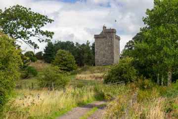
- Lamington Tower Secular: tower SM2629
- Langloch Knowe,fort E of Nisbet Prehistoric domestic and defensive: fort (includes hill and promontory fort) SM2636
- Meadowflatt,enclosure 900m NW of Prehistoric domestic and defensive: enclosure (domestic or defensive) SM4068
- Castle Hill,earthwork,Symington Prehistoric domestic and defensive: enclosure (domestic or defensive) SM2764
- Devonshaw Hill,cairn Prehistoric ritual and funerary: cairn (type uncertain) SM4235
- Burghmuir Farm,enclosures 550m S of Prehistoric domestic and defensive: enclosure (domestic or defensive) SM5492
- Coulter Motte,motte,Wolfclyde Secular: motte SM90082
- Cow Castle,fort Prehistoric domestic and defensive: fort (includes hill and promontory fort) SM2507
- Easter Toftcombs,fort 820m NW of Prehistoric domestic and defensive: fort (includes hill and promontory fort) SM2611
- White Hill, cairn 300m S of Prehistoric ritual and funerary: cairn (type uncertain) SM3162
- Nisbet,hut circle 640m ENE of Prehistoric domestic and defensive: hut circle, roundhouse SM2639
- Hillhead,earthwork 930m N of homestead moat Secular: homestead moat SM2653
- Richard's Knowe Strip,settlement 150m WNW of St John's Kirk Prehistoric domestic and defensive: settlement SM2624