Dunsyre
Dunsyre is a Village in the county of South Lanarkshire.
Dunsyre postcode: ML11 8FL
There are great places to visit near Dunsyre including some great towns and shopping centres.
The area around Dunsyre's best towns can be found at East Kilbride.
Shopping Centres to visit near Dunsyre include EK - East Kilbride.
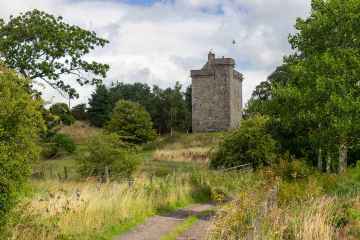
Dunsyre History
There are some historic monuments around Dunsyre:
- Clashpock Rig,homestead Prehistoric domestic and defensive: homestead SM3217
- Heavyside,two enclosures 1000m E of Prehistoric domestic and defensive: enclosure (domestic or defensive) SM4107
- North Muir,Upper Cairn Prehistoric ritual and funerary: cairn (type uncertain) SM2709
- Stirkfield Rig,ring enclosures Prehistoric ritual and funerary: enclosure (ritual or funerary) SM3151
- Lochurd Farm,ring enclosures & mound 1550m S of Prehistoric ritual and funerary: enclosure (ritual or funerary) SM3006
- Castle Hill,fort 550m WSW of Candybank Prehistoric domestic and defensive: fort (includes hill and promontory fort) SM2668
- Kersewell Mains, cairn 450m NE of Prehistoric ritual and funerary: cairn (type uncertain) SM11201
- Blyth Hill,fort Prehistoric domestic and defensive: fort (includes hill and promontory fort) SM2990
- Waulkmill, cairn 310m SE of Prehistoric ritual and funerary: cairn (type uncertain) SM11284
- Dunsyre Hill,field systems Prehistoric domestic and defensive: field or field system SM3371
- Stirkfield,barrow and enclosed cremation cemetery 1120m ESE of Prehistoric ritual and funerary: barrow SM3150
- Newmill,enclosures SW of Prehistoric domestic and defensive: enclosure (domestic or defensive) SM3069
- High House of Edmonston,tower house Secular: castle SM5277
- Ewe Hill,barrows 750m NE of Biggarshiels Farm Prehistoric ritual and funerary: barrow SM4645
- Broughtonknowe,three barrows 230m SE of Prehistoric ritual and funerary: barrow SM2922
- Kersewell Mains,cairn 1400m ENE of Prehistoric ritual and funerary: cairn (type uncertain) SM4662
- Slipperfield Mount,cairn S of Prehistoric ritual and funerary: cairn (type uncertain) SM3698
- Bizzyberry Hill,fort & Wallace's Well Prehistoric domestic and defensive: fort (includes hill and promontory fort); Secular: well SM2607
- Dunsyre Hill,cairn Prehistoric ritual and funerary: cairn (type uncertain) SM3370
- West Mains,enclosure 200m NE of Prehistoric domestic and defensive: enclosure (domestic or defensive) SM3256
- Burngrange,long cairn 800m N of Prehistoric ritual and funerary: long cairn SM4295
- Hardgatehead,Roman road and turnpike road 600m SW of Roman: road; Secular: road SM3263
- South Slipperfield,barrows 1850m SSW and 1620m S of Prehistoric ritual and funerary: barrow SM5742
- Old Harestanes,stone circle 180m NE of Prehistoric ritual and funerary: stone circle or ring SM2697
- Whitewellbrae Wood, henge 60m E of NE corner Prehistoric ritual and funerary: henge SM3369
- Stirkfield,settlements and cultivation remains 1300m ESE of Prehistoric domestic and defensive: settlement SM2939
- Camilty Hill,enclosure,Harburn Prehistoric domestic and defensive: enclosure (domestic or defensive) SM1165
- Harperrig, cairn, West Cairn Hill Prehistoric ritual and funerary: cairn (type uncertain) SM2980
- Skirling Mains,enclosure 320m WSW of Prehistoric domestic and defensive: enclosure (domestic or defensive) SM3265
- Gillespie Moat,motte,Parkmanse Garden Secular: motte SM2643
- Easter Toftcombs,fort 820m NW of Prehistoric domestic and defensive: fort (includes hill and promontory fort) SM2611
- Newbigging market cross Crosses and carved stones: market cross SM2307
- Broughton Knowe,ring enclosures Prehistoric ritual and funerary: enclosure (ritual or funerary) SM3152
- Burghmuir Farm,enclosures 550m S of Prehistoric domestic and defensive: enclosure (domestic or defensive) SM5492
- Bryland,fort 640m SE of Prehistoric domestic and defensive: fort (includes hill and promontory fort) SM3007
- North Muir,cairns Prehistoric ritual and funerary: cairn (type uncertain) SM3544
- Blyth,cairn 1050m NNW of Prehistoric ritual and funerary: cairn (type uncertain) SM2905
- Broughtonknowe, ring enclosures & barrow 420m NE of Prehistoric ritual and funerary: barrow SM2923
- Shaw Hill,cairn Prehistoric ritual and funerary: cairn (type uncertain) SM3236
- Camilty Hill,Roman fortlet,Castle Greg Roman: fortlet SM1933
- Langlaw Hill,fort,enclosure & barrows Prehistoric domestic and defensive: enclosure (domestic or defensive); Prehistoric ritual and funerary: barrow SM3033
- North Muir,Nether Cairn Prehistoric ritual and funerary: cairn (type uncertain) SM2708
- Kersewell Mains,cairn 1400m E of Prehistoric ritual and funerary: cairn (type uncertain) SM4663
- Muirburn Castle,fort & scooped settlement Prehistoric domestic and defensive: fort (includes hill and promontory fort) SM3142
- Crosswood, cairn 750m SE of Prehistoric ritual and funerary: cairn (type uncertain) SM11245
- Greens Moor,long cairn,cairns and field system NW of Kersewell Mains Prehistoric domestic and defensive: field or field system; Prehistoric ritual and funerary: cairn (type uncertain) SM4212
- Brownsbank,enclosure 300m SE of Stirkfield Farm Prehistoric domestic and defensive: enclosure (domestic or defensive) SM4109
- Pyked Stane,cairn,Pyked Stane Hill Prehistoric ritual and funerary: cairn (type uncertain) SM2938