Crawford
Crawford is a Village in the county of South Lanarkshire.
Crawford postcode: ML12 6TP
There are great places to visit near Crawford including some great towns and shopping centres.
The area around Crawford's best towns can be found at East Kilbride.
The area around Crawford's best shopping centres can be found at EK - East Kilbride.
Crawford History
There are some historic monuments around Crawford:
- North Shortcleugh,platform settlement 1500m E of Prehistoric domestic and defensive: platform settlement SM4296
- Devonshaw Hill,cairn Prehistoric ritual and funerary: cairn (type uncertain) SM4235
- Broadhill End,cairn Prehistoric ritual and funerary: cairn (type uncertain) SM4297
- Boghead,platform settlement 500m SW of Prehistoric domestic and defensive: platform settlement SM4603
- Wildshaw Hill,cairn 500m WSW of summit Prehistoric ritual and funerary: cairn (type uncertain) SM4511
- Glengeith, settlement, bastle house and field system Prehistoric domestic and defensive: homestead; Secular: settlement, including deserted, depopulated and townships SM4798
- Historic gold workings, Leadhills, South Lanarkshire Industrial: mines, quarries SM13677
- Fall Kneesend, enclosed cremation cemetery Prehistoric ritual and funerary: enclosed cremation cemetery SM3947
- Abington,motte & bailey 1600m N of Secular: bailey SM2609
- Castle Crawford Farm,fort 500m NW of Prehistoric domestic and defensive: fort (includes hill and promontory fort) SM2616
- Bodsberry Hill,fort Prehistoric domestic and defensive: fort (includes hill and promontory fort) SM2605
- Normangill Rig,cairn 1000m S of Normangill Prehistoric ritual and funerary: cairn (type uncertain) SM4526
- Fagyad Hill,cairn Prehistoric ritual and funerary: cairn (type uncertain) SM4254
- Normangill,henge Prehistoric ritual and funerary: henge SM3292
- Whelphill, unenclosed platform settlement 390m W of Prehistoric domestic and defensive: platform settlement SM4531
- Dungavel Hill,cairn Prehistoric ritual and funerary: cairn (type uncertain) SM4261
- Bodsberry Hill to Little Clyde,Roman road Roman: road SM3941
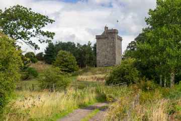
- Crawford Castle or Lindsay Tower Secular: castle SM2633
- Collins Burn,enclosure 750m NW of Elvanfoot Bridge Prehistoric domestic and defensive: enclosure (domestic or defensive) SM4527
- Midlock,platform settlement 1000m ESE of Prehistoric domestic and defensive: platform settlement SM4757
- Netherton,cairn 800m SW of Prehistoric ritual and funerary: cairn (type uncertain) SM4513
- Devonshaw Hill,cairn 700m ENE of Prehistoric ritual and funerary: cairn (type uncertain) SM4243
- Crawford,Roman fort Roman: fort SM2632
- Normangill Rig,platform settlement E of Midlock Prehistoric domestic and defensive: platform settlement SM4756
- Crookedstane,platform settlement 1300m W of Prehistoric domestic and defensive: platform settlement SM4646
- Windgate House,bastle house and associated structures Secular: enclosure SM5257
- Hillend,enclosures 250m ENE of Prehistoric domestic and defensive: enclosure (domestic or defensive); Prehistoric ritual and funerary: henge SM5451
- Devonshaw Hill,enclosure 300m NNE of summit Prehistoric domestic and defensive: enclosure (domestic or defensive) SM4512
- Craighead, platform settlement 1200m WNW of Prehistoric domestic and defensive: platform settlement SM4485
- Glencaple,burnt mound 980m WNW of Prehistoric domestic and defensive: burnt mound SM5267
- March Burn to Little Clyde,Roman road Roman: road SM3348
- Glencaple,platform settlement 600m NW of Prehistoric domestic and defensive: platform settlement SM4249
- The Bower of Wandel, Tower. Secular: tower SM8775
- Little Clyde,Roman camp Roman: camp SM2745
- Camps Knowe Wood,fort Prehistoric domestic and defensive: fort (includes hill and promontory fort) SM2437
- Watermeetings,platform settlement 450m W of Prehistoric domestic and defensive: platform settlement SM4644
- Craighead, barrow and cairn 820m NW of Prehistoric ritual and funerary: barrow SM4517
- Kirkton,settlement 1280m ENE of Prehistoric domestic and defensive: settlement SM2617
- Kirkton,fort 1155m ENE of Prehistoric domestic and defensive: fort (includes hill and promontory fort) SM2822
- Wandel,Roman fortlet and camp 460m SW of Roman: fortlet SM2835
- Black Hill,fort 650m NW of Craighead Prehistoric domestic and defensive: fort (includes hill and promontory fort) SM2606
- Crooked Stone, standing stone 160m N of Crookedstane Prehistoric ritual and funerary: standing stone SM4238
- Air Cleuch,cairns 1300m S of Glengeith Prehistoric domestic and defensive: field clearance cairn, cairnfield; Prehistoric ritual and funerary: cairn (type uncertain) SM4641
- Stoneyburn,platform settlement and field system 700m WSW of Prehistoric domestic and defensive: field or field system SM4486
- Castle Crawford Farm,enclosure 585m NNW of Prehistoric domestic and defensive: enclosure (domestic or defensive) SM2631
- North Shortcleuch,platform settlement 1000m E of Prehistoric domestic and defensive: platform settlement SM4516
- Campshead,unenclosed platform settlement 800m WNW of Prehistoric domestic and defensive: platform settlement SM4735
- Castle Dykes,earthwork,Roberton Prehistoric domestic and defensive: enclosure (domestic or defensive) SM2596
- Kirkton,fort 860m NNE of Prehistoric domestic and defensive: fort (includes hill and promontory fort) SM2614
- Stoneyburn,cairns 800m SW of Prehistoric ritual and funerary: cairn (type uncertain) SM4515
- Berries Burn,cairn 800m NNW of Castle Crawford Farm Prehistoric ritual and funerary: cairn (type uncertain) SM4487
- Crookedstane,platform settlement 200m E of Prehistoric domestic and defensive: platform settlement SM4647
- Cold Chapel,settlement 500m NE of Prehistoric domestic and defensive: settlement SM4530
- Arbory Hill,fort Prehistoric domestic and defensive: fort (includes hill and promontory fort) SM264
- Midlock,cairn 640m NE of Prehistoric ritual and funerary: cairn (type uncertain) SM4256
- Glenochar Burn,bastle house,post-medieval settlement & field system Secular: settlement, including deserted, depopulated and townships SM5385
- Devonshaw Hill,fort 500m NE of Woodend Farm Prehistoric domestic and defensive: fort (includes hill and promontory fort) SM2502
- Baitlaws,cairn 750m ENE of Prehistoric ritual and funerary: cairn (type uncertain) SM4344
- Lettershaws,platform settlement 1000m NE of Prehistoric domestic and defensive: platform settlement SM4332
- Nap Hill, Roman signal station 900m SE of Little Clyde Roman: signal station SM102
- Fall Hill,enclosed cremation cemetery 650m NE of Midlock Prehistoric ritual and funerary: enclosed cremation cemetery SM4766
- Wintercleugh,bastle house 1000m S of Tomont Hill Secular: bastle SM5279
- Castle Hill Strip,fort Prehistoric domestic and defensive: fort (includes hill and promontory fort) SM2635