Carmichael
Carmichael is a Village in the county of South Lanarkshire.
Carmichael postcode: ML12 6PQ
There are great places to visit near Carmichael including some great towns and shopping centres.
Carmichael is near some unmissable towns like East Kilbride,
There are a number of shopping centres near to Carmichael including EK - East Kilbride.
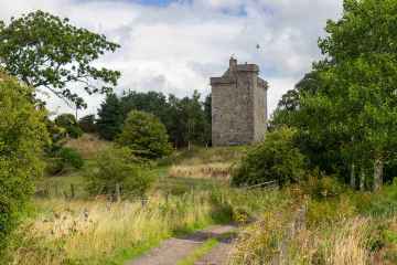
Carmichael History
There are some historic monuments around Carmichael:
- Covington,castle & dovecot Secular: castle SM2599
- Castle Hill Strip,fort Prehistoric domestic and defensive: fort (includes hill and promontory fort) SM2635
- Collielaw Wood, Roman road SSE of Collielaw Roman: road SM11528
- Thorril Castle,bastle house 450m NNE of Parkhead Secular: farmstead SM5425
- Hillhead,earthwork 1220m NNW of Prehistoric domestic and defensive: enclosure (domestic or defensive) SM2652
- Thankerton,fort 1500m SW of Prehistoric domestic and defensive: fort (includes hill and promontory fort) SM2610
- Park Knowe,enclosure 1500m SSW of Thankerton Prehistoric domestic and defensive: enclosure (domestic or defensive) SM2603
- Carstairs Mains, Roman temporary camp 750m SE of Roman: camp SM11200
- Castle Hill,earthwork 820m SW of Prehistoric domestic and defensive: enclosure (domestic or defensive) SM2741
- Devonshaw Hill,cairn 700m ENE of Prehistoric ritual and funerary: cairn (type uncertain) SM4243
- Castledykes,Roman fort,Corbiehall Roman: fort SM1139
- Chester Hill,fort Prehistoric domestic and defensive: fort (includes hill and promontory fort) SM2598
- Castle Dykes,earthwork,Roberton Prehistoric domestic and defensive: enclosure (domestic or defensive) SM2596
- St John's Kirk,fort 360m WNW of Prehistoric domestic and defensive: fort (includes hill and promontory fort) SM2634
- St Kentigern's Church, Lanark Ecclesiastical: church SM1144
- Hillhead,earthwork 930m N of homestead moat Secular: homestead moat SM2653
- Castledykes, Roman camps to W, N & E of Roman fort Roman: camp SM3825
- Dungavel Hill,cairn Prehistoric ritual and funerary: cairn (type uncertain) SM4261
- Carnwath Golf Course,motte Secular: motte SM1145
- Richard's Knowe Strip,settlement 150m WNW of St John's Kirk Prehistoric domestic and defensive: settlement SM2624
- New Lanark, Mill Number Four Industrial: textiles SM12701
- Camp Wood, Roman camp 335m SW of Campwood Farm Roman: camp SM1138
- Corra Castle Secular: castle SM2597
- Castle Hill,site of Lanark Castle Secular: castle SM2612
- Devonshaw Hill,fort 500m NE of Woodend Farm Prehistoric domestic and defensive: fort (includes hill and promontory fort) SM2502
- Devonshaw Hill,cairn Prehistoric ritual and funerary: cairn (type uncertain) SM4235
- Hyndford House,crannog 135m NNW of Prehistoric domestic and defensive: crannog SM2595
- Wildshaw Hill,cairn 500m WSW of summit Prehistoric ritual and funerary: cairn (type uncertain) SM4511
- Greenaton Farm, enclosed settlement 250m WNW of Prehistoric domestic and defensive: enclosure (domestic or defensive) SM11214
- Eastmore, barrow 390m NNE of Prehistoric ritual and funerary: barrow SM13694
- Lamington Tower Secular: tower SM2629
- Devonshaw Hill,enclosure 300m NNE of summit Prehistoric domestic and defensive: enclosure (domestic or defensive) SM4512
- Meadowflatt,enclosure 900m NW of Prehistoric domestic and defensive: enclosure (domestic or defensive) SM4068
- Tinto Cairn,cairn on summit of Tinto Hill Prehistoric ritual and funerary: cairn (type uncertain) SM4660
- The Bower of Wandel, Tower. Secular: tower SM8775
- Castle Qua,fort 345m WSW of Mouse Bridge Prehistoric domestic and defensive: fort (includes hill and promontory fort) SM2604
- Couthally Castle,Carnwath Secular: castle SM3909
- Corbiehall Farm, enclosure 570m NNE of Prehistoric domestic and defensive: enclosure (domestic or defensive) SM13610
- Hillend,enclosures 250m ENE of Prehistoric domestic and defensive: enclosure (domestic or defensive); Prehistoric ritual and funerary: henge SM5451
- Blackhouse Burn,enclosures Prehistoric ritual and funerary: enclosure (ritual or funerary) SM4063