Tal-y-sarn
Tal-y-sarn is a Village in the county of Gwynedd.
Tal-y-sarn postcode: LL54 6AX
There are great places to visit near Tal-y-sarn including some great towns, ancient sites, mountains, lakes, historic monuments, old mines and ruins.
Pwllheli, and Barmouth are great places to visit near Tal-y-sarn if you like towns.
There are a number of ancient sites near to Tal-y-sarn including St. Cybi's Well.
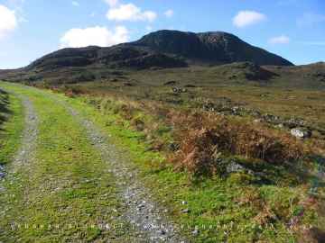
Tal-y-sarn's best nearby mountains can be found at Y Garn, Arenig Fawr, Snowdon, and Cnicht.
Lakes to visit near Tal-y-sarn include Llyn Ogwen, and Llyn Arenig fawr.
Historic Monuments to visit near Tal-y-sarn include Arenig Fawr.
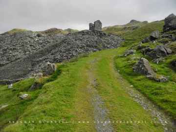
Don't miss Croesor Quarry's old mines if visiting the area around Tal-y-sarn.
Tal-y-sarn is near some unmissable ruins like Croesor Quarry,
Tal-y-sarn History
There are some historic monuments around Tal-y-sarn:
- Pen-yr-Orsedd Quarry, Blondins and Associated Structures
- Segontium Roman Site
- Graianog Standing Stone & Round Cairns
- Caer Engan
- Blaen y Cae Slate Quarry
- Craig-y-Tyddyn Camp
- Early Habitation Site 180m West of Pen-Yr-Allt
- Cross Inscribed Stone Near Capel Uchaf
- Enclosed Hut Group North-East of Llystyn Uchaf
- Pen-Isa'r-Waen Camp
- Cae'r Odyn Unenclosed Hut
- Enclosed Hut Circle Settlement West of Votglas
- Hut Group near Pen Llwyn, Carmel
- Y Garn cairns
- Hut Settlement at Mynydd Graig Goch, North
- Ty Coch Prehistoric Settlement
- Penbryn Mawr standing stone
- Hut Group Near Tan-y-Coed Pont Rhythallt
- Llystyn Gwyn Inscribed Stone
- Craig Cwmbychan cairn
- Enclosed Hut Circle North-West of Tan Rhiw
- Y Foel Camp
- Lower Roman Fort
- Drws y Coed Prehistoric Settlement
- Hut Group & Field System North West of Tyddyn Mawr (previously known as Hut Group NW of Tyddyn Mawr)
- Hut and Enclosure Near Mur-Moch
- Gesail Gyfarch Inscribed Stone
- Hut Circle Settlement Above Gilfach
- Pont y Cim
- Burnt Mound East of Pen-y-Gaer
- Hafod-y-Wern Long Hut
- Hut Circle South of Cae'r Sais
- Hut Circle East of Taleifion
- Hafotty Wern Las Hut Group & Fields
- Penarth Burial Chamber
- Ancient Village 270m West of Bod Angharad
- Bryn-Glas Roman Signal Station
- Pen y Gaer Camp
- Huts & Field Systems NE of Nantlle
- Cored Gwyrfai Fish Weir
- Hut Group and Field System E of Coed-y-Brain
- Prince of Wales Quarry
- Hut Group North of Cwmceiliog
- Glynllifon standing stone
- Castell Caerau
- Enclosed Hut Group North West of Cwm Farm
- Dinas Dinlle Camp
- Ty Mawr East Slate Quarry Winding Engine House
- Craig Cwm Silyn round cairn
- Hut Circle Settlement and Field System South-East of Erw
- Drws y Coed Copper Mine
- Tyddyn Mawr, standing stone to SSW of
- Enclosed Hut Circle West of Llwyn Bedw
- Mynydd Graig Goch round cairn
- Hut Settlement at Mynydd Graig Goch, Central
- Hut Circles NE of Garreg Lefain
- Dinas Dinlle Seagull Trench
- Cloddfa'r Lon Slate Quarry
- Carreg Lefain Cairn
- Caerau Ancient Village
- Hut Circles at Braich y Cornel
- Dinas y Prif Camp
- Hafoty Ty-Newydd Enclosed Hut Group
- Huts and Enclosures, Cwm Llefrith
- Small Fort Near Nantlle
- Dolbenmaen Castle Mound
- Hut Group, Near Galltycelyn, S of Cwm-y-Glo
- Dorothea Quarry Beam Engine
- Ystrad Rural Settlement
- Hut Circle Settlement North of Bryn Mair
- Hut Circle Settlement East of Dinas-y-Prif
- Hut Circle Settlement West of Cwm Farm
- Caer Carreg y Fran
- Maen Llwyd in Glynllifon
- Caernarfon Castle
- Enclosed Hut Circle Settlement North of Rhedynog Felen Bach
- Parc y Gleision Standing Stone
- Cwm Llefrith cairn
- Cae-Bach Hut Circle Settlement
- Gilfach Copper Mine
- Hut Settlement at Mynydd Graig Goch, South
- Garnedd-goch round cairn
- Enclosed Hut Circle Settlement in Coed Glan-yr-Afon
- Huts and Enclosures above Ceunant y Ddol
- Gorseddau or Ynysypandy Slate Factory
- Long Hut North of Cwm Farm
- Craig y Dinas Camp
- Caernarfon Town Wall
- Dorothea Quarry, Pyramids, Inclines, Mill & Winding Houses, etc