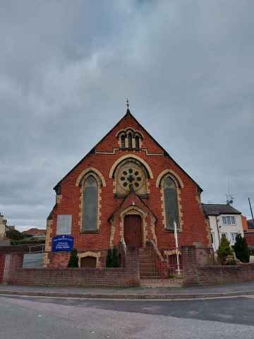
Cadole
Cadole is a Village in the county of Flintshire (Sir y Fflint).
Cadole postcode: CH7 5LJ
There are great places to visit near Cadole including some great towns, castles, ruins, hills, ancient sites, hiking areas and country parks.
Towns to visit near Cadole include Buckley, and Flint.
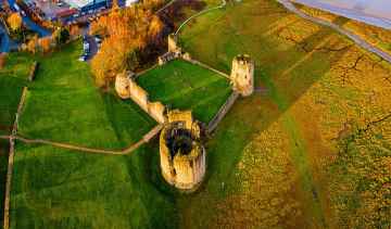
Places near Cadole feature a number of interesting castles including Flint Castle - Castell y Fflint.
Don't miss Flint Castle - Castell y Fflint's ruins if visiting the area around Cadole.
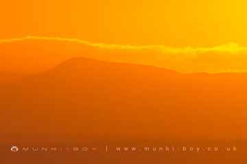
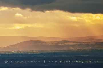
There are a number of hills near Cadole including Clwydian Range, Moel Famau, Moel Llys-y-Coed, Moel Arthur, and Hope Mountain.
Don't miss Moel Arthur's ancient sites if visiting the area around Cadole.
The area close to Cadole boasts some of the best hiking areas including Hope Mountain.
Places near Cadole feature a number of interesting country parks including Waun-Y-Llyn Country Park.
Cadole History
There are some historic monuments around Cadole:
- Moel Llech Round Barrow
- Bryn y Cwm Mound & Bailey Castle
- Round Barrow 495m SE of Parc y Prysau
- The Bailey Hill, Mold
- Taylor's Pottery
- Pen-y-stryt round barrow
- Hafod Wood Moated Site
- Carreg-y-llech standing stone
- Moel Fenlli Camp
- Moel y Plas Round Barrow
- Croes Atti Roman Site
- Round Barrow 450m E of Penbedw Hall
- Pentre round barrow
- Minera Hoffman Limekiln
- Maes Maelor Round Barrow
- Flint Castle
- Coed Henblas Moated Site
- Bron Fadog Enclosure
- Round Barrow at Pentrehobin
- Wat's Dyke: Section from Chester-Holywell Road to Soughton Farm
- Llyfanod round barrow
- Llyn Cyfnwy Round Barrow
- Cas-Gan-Ditw Round Barrow
- Hen Blas Castle Site
- Rhos-Ddigre Caves
- Round Barrow 180m E of Mwccwd
- Bryntirion round barrow
- Bryn y Cosyn Round Barrows
- Wat's Dyke: Sections S of Bryn y Bal
- Wat's Dyke: Section from Coed Llys to Chester-Holywell Road
- Moel Arthur Camp
- Hen-y-Fail Round Barrow
- Coed Clwyd Cairns
- Tomen y Faerdre Castle Mound
- Wat's Dyke: Section N & E of New Brighton
- Bryn Castell Castle Mound
- Wat's Dyke: Section from Bod Offa to Whitehouse Farm
- Moel Eithinen Round Barrow
- Bank of Six Vertical Limekilns at Minera Quarry
- Offa's Dyke: Section extending 477m from Coed Talon Banks
- Round Barrow WSW of Llyfanod
- Rhual-Isaf Round Barrow
- Round Barrow 225m SE of Parc y Prysau
- Groes Faen Bach round barrow
- Llys Edwin Medieval Fortified House Site
- Tyn-y-Mynydd Round Barrow
- Round Barrow 270m NW of Waen Isaf
- Nercwys Mountain Cairn
- Moel y Gaer Camp
- Tomen y Rhodwydd (Castell yr Adwy) Mound and Bailey Castle
- Moel Gyw Round Barrow
- Plas-newydd Romano-British temple cropmark
- Churchyard Cross, St Meugan's Church
- Pentre Bridge Roman Site
- Moel-y-Gaer Camp
- Gatehouse Farm round barrow
- Tyddyn Castle Mound
- Round Barrow 180m NW of Groesfaen
- Wat's Dyke: Section SE of Clawdd Offa
- Ministry of Supply Valley Site
- Penbedw Park Stone Circle & Standing Stone
- Plas-Yw Round Barrows
- Cefn Coch Tumulus