
Thorpe le Street
Thorpe le Street is a Village in the county of East Riding of Yorkshire.
Thorpe le Street postcode: YO42 4LJ
There are great places to visit near Thorpe le Street including some great towns.
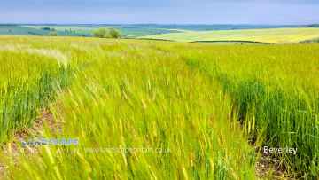
The area around Thorpe le Street's best towns can be found at Beverley.
Thorpe le Street History
There are some historic monuments around Thorpe le Street:
- Round barrow 320m south-west of High Barn Farm
- Round barrow 930m north east of Dalton Gates Farm
- Moated site 170m north of Wholsea Farm
- Site of Warter Augustinian Priory
- Moated grange at Monk Farm
- Bowl barrow 560m NNW of Farberry Garth Farm
- Round barrow 390m south-west of High Barn Farm
- Round barrow 360m south-west of High Barn Farm
- Bowl barrow 170m north west of Farberry Garth Farm
- Round barrow 250m east of Wold Farm, Bishop Wilton Wold
- Round barrow 520m S of Warren Farm
- Cross base and shaft and cross base at St Margaret's Church
- Two round barrows 820m north east of Dalton Gates Farm
- Ousethorpe medieval settlement, moat and mill 310m south of Ousethorpe Farm
- Bowl barrow 290m south east of Blanch Farm
- Three round barrows 110m east of Coldwold Farm
- Bowl barrow 210m south east of Blanch Farm
- Park Closes moated lodge, 130m south west of Park Farm
- Round barrow 270m south-east of Blanch Farm
- Section of linear boundary dyke between Sylvan Dale and Warren Farm, north west of Coldwold Farm
- Round barrow 450m north east of Blanch Farm
- Section of linear boundary dyke on Cow Moor, Millington Dale
- Round barrow 400m north-west of Cobdale Farm
- Round barrow 380m south-west of High Barn Farm
- Round barrow on Thirty Acres, Warter
- Two bowl barrows 500m north west of Farberry Garth Farm
- Bolton Old Hall moated site
- Bowl barrow 720m NNW of Farberry Garth Farm
- Cleaving Hall moated site
- Two bowl barrows 300m south east of Blanch Farm
- Round barrow 915m north east of Dalton Gates Farm
- Site of Nunburnholme Priory
- Deepdale cross ridge dyke
- Round barrow 240m south-west of High Barn Farm
- Bowl barrow 760m NNE of Farberry Garth Farm
- Round barrow 100m SW of Cobdale Farm
- Bowl barrow 230m south west of High Barn Farm
- Section of double linear boundary dyke 300m north east of Millington Grange Farm
- Round barrow 600m west of Newcote Farm
Places to see near Thorpe le Street
Lakes near Thorpe le Street
Canals near Thorpe le Street
Rivers near Thorpe le Street
- Upper Fox Drain Catchment ds of Sherburn STW
- Ouse from R Wharfe to Upper Humber
- Bishop Dike (Trib of Ouse)
- Stillingfleet Beck Source to Ouse
- Mill Dike from Source to Bishop Dike
- Riccall Dam Catchment (trib of Ouse)
- Selby Dam from Conf. Fox Dike and Carr Dike to Ouse
- Ouse Still/fleet bk - Kelfield and Wharfe d/s Ryther
- Fox Dike/Carr Dike from Source to Selby Dam
- Holmes Dike catchment (trib of Ouse)
- Danes Dyke
- Gypsey Race from Source to North Sea
- Barmston Sea Drain / Skipsea Drain to Conf
- Barmston Sea Drain from Skipsea Drain to N Sea
- Gransmoor Drain (Burton Agnes to Lissett Area)
- Earls Dyke from Source to North Sea
- Auburn Beck from Source to North Sea
- Steam Dyke Hornsea Mere to N Sea
- Oldfleet/Wyton/Sproatley Drain from Source to Humber
- Burton Pidsea Drain Lower Catchment
- Fosse drain / Skeffling Drain
- Ottringham Drain from Ottringham Grange to Humber
- Burstwick Drain from Source to Humber
- Humbleton Beck Catchment
- Sands/Keyingham/Roos Dr from Source to Humber
- Winestead Drain from Source to Humber
- Mill Beck 3 (N Cave to High Humsley Area)
- Mill Beck 4 (N and S Newbald Area)
- Mill Beck 2 (Ellerker Area)
- Foulness from Source to Black Beck (South)
- Foulness from Black Beck to Market Weighton Canal
- Wellsprings Drain/Eastburn Beck/Driffield Trout Stream
- Scurf Dike from Source to River Hull
- Skerne Beck
- Nafferton Beck from Source to to Driffield Canal
- Lowthorpe/Kelk/Foston Bks from Source to Frodingham Beck
- Old Howe/Frodingham Beck to R Hull
- West Beck Lower to River Hull
- Garton Wold / Water Forlorns
- Hull from West Beck to Arram Beck
- West Beck Upper
- Mickley Dike Catchment
- Conistone Ganstead Area
- Fleet Drain
- Ella Dyke
- Fordyke Stream Lower to Holderness Dr
- Hull from Arram Beck to Humber
- High Hunsley to Arram Area
- Lambwath Stream from Source to Foredyke Stream
- Scorborough Beck
- Bryan Mills Beck Source to Bryan Mills Farm
- Middleton on the Wolds and Watton Beck
- Holderness Drain from Fordyke Stream to Humber
- Holderness Drain Source to Fordyke Stream
- High Hunsley to Woodmansey Area
- Foredyke Stream Upper
- Catchwater Drain
- Beverley and Barmston Drain
- Bishop Wilton Beck Catch (trib of Blackfoss Beck)
- Birk Lane Drain Catch (trib of Derwent)
- Bielby Beck from Source to Pocklington Beck
- Gowthorpe Beck Catch (trib of Blackfoss Beck)
- Pocklington Beck from Source to Bielby beck
- Lowmoor Drain Catch (trib of Derwent)
- Blackfoss Bk lower Catch (trib of Pocklington Bk)
- Pocklington Beck from Bielby Bk to River Derwent
- Derwent from Elvington Beck to River Ouse
- Fleet Dike catch (trib of Ouse)
- Eastfield Drain Lower to River Hertford
- Sherburn Beck catchment (trib of Derwent)
- Lowdales Beck Catchment (trib of Derwent)
- Black/Crosscliff/Grain Bk from Source to R Derwent
- Ruston Beck catchment (trib of Derwent)
- The Syme form Source to Thornton/Dalby/Staindale
- Ebberston Beck catchment (trib of Derwent)
- Hertford from Source to River Derwent
- Lownorth Beck from Source to River Derwent
- Derwent from Source to Black Beck
- Seamer Drain from Source to River Hertford
- Thornton/Dalby/Staindale from Source to the Syme
- Brompton Beck catchment (trib of Derwent)
- Troutsdale Beck from Source to River Derwent
- Scampston Beck catchment (trib of Derwent)
- Burniston Beck/Sea Cut/Scalby Beck Catch to N Sea
- Derwent from Black Beck to River Rye


