
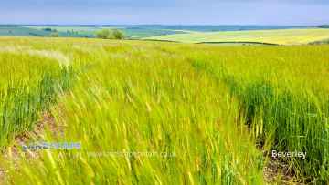
Huggate
Huggate is a Village in the county of East Riding of Yorkshire.
Huggate postcode: YO42 1YG
There are great places to visit near Huggate including some great towns.
The area around Huggate's best towns can be found at Beverley.
Huggate History
There are some historic monuments around Huggate:
- Three round barrows 110m east of Coldwold Farm
- Cross base and shaft and cross base at St Margaret's Church
- Site of Nunburnholme Priory
- Bowl barrow on Huggate Wold, 400m NNW of Watermanhole Reservoir
- Two round barrows 820m north east of Dalton Gates Farm
- A bowl barrow on Toisland Wold, 580m east of Toisland Farm
- Round barrow south-west of Uncleby Wold Barn
- Round barrow 450m north east of Blanch Farm
- Bowl barrow in Towthorpe Plantation, 1km NNE of Burdale North Wold
- Bowl barrow 720m NNW of Farberry Garth Farm
- Round barrow 1300m east of Life Hill
- Bowl barrow in Towthorpe Plantation, 600m north east Towthorpe High Barn
- A bowl barrow on Birdsall Brow, 1km north-east of Toisland Farm
- Round barrow 730m NNW of Goodmanham Wold Farm
- Barrow W of Bradeham Farm
- A bowl barrow on Birdsall Wold, 250m south-east of Vessey Pasture Farm
- A cross-dyke on Birdsall Brow
- Bowl barrow on Huggate Wold, 700m north west of Horsedale Plantation
- Wharram Percy deserted medieval village
- Bowl barrow 230m south west of High Barn Farm
- Sections of linear boundary dyke in Frendal Dale, Tun Dale, and Great Plantation, between Millington and Huggate Wolds
- A bowl barrow on Birdsall Wold, 530m east of Aldro Farm
- A bowl barrow on Birdsall Wold, 475m north-west of Vessey Pasture Farm, incorporating part of a linear boundary
- Bowl barrow in Towthorpe Plantation, 400m north west of Towthorpe High Barn
- Round barrow 1400m east of Life Hill
- Bowl barrow 340m south east of Watermanhole Reservoir
- Round barrow 250m north east of Painsthorpe Wold Cottages
- Bowl barrow on Huggate Wold, 840m ENE of Watermanhole Reservoir
- Round barrow 320m south-west of High Barn Farm
- Round barrow, north east of Greenwick Lodge
- Cleaving Hall moated site
- Bowl barrow 760m NNE of Farberry Garth Farm
- Hanging Grimston barrow group: a bowl barrow 650m SSW of Thixendale Grange
- Round barrow 380m south-west of High Barn Farm
- Section of single linear boundary dyke east of York Lane, south east of Farclose Plantation
- Round barrow 360m south-west of High Barn Farm
- Round barrow south west of Uncleby Wold Barn
- Bowl barrow on Huggate Pasture, 500m north of Pasture Dale Plantation
- Bowl barrow on Huggate Wold, 580m north west of Horsedale Plantation
- Two bowl barrows on Birdsall Wold, between Birdsall Dale and Vessey Pasture Dale
- Sections of linear boundary dyke in Harper Dale and Holm Dale, north east of Horsedale Plantation
- Two bowl barrows 300m south east of Blanch Farm
- Bowl barrow in Towthorpe Plantation, 370m WSW of Canada Cottages
- Section of single linear boundary dyke in Horse Dale, 550m north west of Glebe Farm
- Bowl barrow on Huggate Wold, 500m NNW of Horsedale Plantation
- Bowl barrow 700m west of Wharram Percy Farm
- Bowl barrow 500m east of Blanch Farm
- Section of linear boundary dyke on Millington Lings 625m north east of High Callis Wold
- Three round barrows in North Dalton village
- Greenlands barrow group: five bowl barrows on Toisland Wold, 500m east of Toisland Farm
- Bowl barrow 780m north east of Watermanhole Reservoir
- A bowl barrow on Toisland Wold, 200m north-east of Toisland Farm
- Bowl barrow 400m NNW of East Greenwick Farm
- Section of double linear boundary dyke 300m north east of Millington Grange Farm
- Round barrow N of manor house
- Bowl barrow 1000m north east of Goodmanham Wold Farm
- Croom medieval settlement and cultivation terraces
- A bowl barrow on Birdsall Wold, 750m east of Aldro Farm
- Round barrow 900m north east of Wayrham Farm
- A cross-dyke from Toisland Wold to Vessey Pasture Dale incorporating a bowl barrow
- A bowl barrow on Birdsall Wold, 250m north-west of Vessey Pasture Farm
- A bowl barrow on Birdsall Wold, 580m east of Aldro Farm
- Hanging Grimston barrow group: four bowl barrows and part of a cross dyke 600m SSW of Thixendale Grange
- Round barrow 350m east of Callis Wold Farm
- Barrow near Middle Plantation
- Bowl barrow 550m north east of Goodmanham Wold Farm
- Round barrow 400m north west of Callis Wold Farm
- Round barrow south-east of Cot Nab Farm
- Section of double linear boundary dyke west of Far Out Field, Millington Wold
- Sections of linear boundary dyke in Cow Dale Plantation, Rabbit Dale and Oxland Plantation
- Twelve bowl barrows 800m north of Goodmanham Wold Farm
- Bowl barrow, 150m south east of Towthorpe Reservoir
- Bowl barrow 600m ESE of Blanch Farm
- Round barrow 250m south of Callis Wold Farm
- Round barrow 100m SW of Cobdale Farm
- Round barrows SW of Riggs Farm
- Bowl barrow on Huggate Wold, 460m WNW of western corner of Horsedale Plantation
- Round barrow 240m south-west of High Barn Farm
- Site of Warter Augustinian Priory
- A bowl barrow on Birdsall Wold, 300m north-east of Vessey Pasture Farm
- Bowl barrow 600m NW of Wharram Percy Farm
- Round barrow 600m north east of Painsthorpe Wold Cottages
- Section of a single and double linear boundary dyke in Horse Dale, and the junctions of Holm Dale and Harper Dale, north west of Northfield Farm
- Section of single linear boundary dyke in Great Plantation, Greenwick Dale, 250m east of East Greenwick Farm
- Round barrow 400m north-west of Cobdale Farm
- A bowl barrow on Toisland Wold, 600m east of Toisland Farm
- Round barrow 330m south east of Painsthorpe Wold Cottages
- A bowl barrow on Birdsall Brow, 600m north-east of Toisland Farm
- Bowl barrow 620m ESE of Blanch Farm
- A bowl barrow on Birdsall Wold, between Birdsall Dale and Vessey Pasture Dale
- Round barrow 930m north east of Dalton Gates Farm
- A cross-dyke from Birdsall Brow to Vessey Pasture Dale incorporating two bowl barrows and a cross-dyke extending from Water Dale
- Bowl barrow 550m south west of Enthorpe House
- Towthorpe medieval settlement
- Section of single linear boundary dyke in Stable Plantation, Greenwick Dale, 400m south west of East Greenwick Farm
- Bowl barrow in Towthorpe Plantation, 800m NNE of Burdale North Wold
- Four bowl barrows and parts of two linear boundary earthworks and a cross-dyke 750m west of Wharram Percy Farm
- Round barrow SE of Gill's Farm
- Hanging Grimston barrow group: four bowl barrows on Uncleby Stoop
- Round barrow 300m south west of Callis Wold Farm
- Settlement at Blealands Nook
- Round barrows S of Gill's Farm
- A bowl barrow on Birdsall Wold, between Birdsall Dale and Vessey Pasture Dale
- Bowl barrow on Huggate Wold, 600m NNW of Horsedale Plantation
- Bowl barrow 230m south west of Enthorpe House
- Bowl barrow 150m NNE of Towthorpe High Barn
- Section of linear boundary dyke on Cow Moor, Millington Dale
- Round barrow 270m south-east of Blanch Farm
- A bowl barrow on Birdsall Wold, 600m east of Aldro Farm
- Hanging Grimston barrow group: three bowl barrows 600m south west of Thixendale Grange
- Round barrow south east of South Wold Farm
- Money Hill round barrow
- Round barrow 350m south east of Fordham Farm
- Round barrow 600m west of Newcote Farm
- Section of linear boundary dyke 390m west of South Wold Farm
- Section of linear boundary dyke in Harper Dale Plantation north east of Northfield Farm
- Two bowl barrows on Huggate Wold, 600m north west of Horsedale Plantation
- Two bowl barrows 500m north west of Farberry Garth Farm
- Bowl barrow 610m east of Blanch Farm
- Round barrows on Wharram Percy Wold
- Sections of multiple linear dykes 125m south west of Cot Nab Farm
- Round barrow on Thirty Acres, Warter
- Bowl barrow 210m south east of Blanch Farm
- A bowl barrow on Toisland Wold, 180m east of Toisland Farm
- Bowl barrow 560m NNW of Farberry Garth Farm
- Bowl barrow 170m north west of Farberry Garth Farm
- Two bowl barrows on Birdsall Wold, 850m east of Aldro Farm
- A bowl barrow on Birdsall Wold, 700m east of Aldro Farm
- Bowl barrow on Huggate Wold, 600m west of Horsedale Plantation
- Round barrow 500m south east of Painsthorpe Wold Cottages
- A bowl barrow on Birdsall Wold, between Birdsall Dale and Vessey Pasture Dale
- Bowl barrow 290m south east of Blanch Farm
- Deepdale cross ridge dyke
- Sections of single and multiple linear boundary dykes on Huggate Pasture and Frendal Dale
- Bowl barrow on Huggate Pasture, 350m north east of Pasture Dale Plantation
- Section of linear boundary dyke 160m west of High Callis Wold Farm
- A cross-dyke in Vessey Pasture Dale
- Section of linear boundary dyke south of Middleham Plantation and Harper Dale Plantation
- Section of linear boundary dyke in and extending to the north west of Farclose Plantation towards Waterman Hole
- Round barrow 520m S of Warren Farm
- Round barrow 390m south-west of High Barn Farm
- Bowl barrow on Huggate Pasture, 450m NNE of Pasture Dale Plantation
- Round barrow 915m north east of Dalton Gates Farm
- Bowl barrow on Huggate Wold, 480m north of Watermanhole Reservoir
- Section of linear boundary dyke between Sylvan Dale and Warren Farm, north west of Coldwold Farm
- Round barrow 850m north east of Wayrham Farm
- Bowl barrow on Huggate Wold, 700m NNW of Watermanhole Reservoir
- Three bowl barrows on Birdsall Wold, 400m north-west of Vessey Pasture Farm
- Round barrow south of South Wold Farm
- Old church
- Bowl barrow 700m south west of Enthorpe House
Places to see near Huggate
Lakes near Huggate
Canals near Huggate
Rivers near Huggate
- Upper Fox Drain Catchment ds of Sherburn STW
- Ouse from R Wharfe to Upper Humber
- Bishop Dike (Trib of Ouse)
- Stillingfleet Beck Source to Ouse
- Mill Dike from Source to Bishop Dike
- Riccall Dam Catchment (trib of Ouse)
- Selby Dam from Conf. Fox Dike and Carr Dike to Ouse
- Ouse Still/fleet bk - Kelfield and Wharfe d/s Ryther
- Fox Dike/Carr Dike from Source to Selby Dam
- Holmes Dike catchment (trib of Ouse)
- Danes Dyke
- Gypsey Race from Source to North Sea
- Barmston Sea Drain / Skipsea Drain to Conf
- Barmston Sea Drain from Skipsea Drain to N Sea
- Gransmoor Drain (Burton Agnes to Lissett Area)
- Earls Dyke from Source to North Sea
- Auburn Beck from Source to North Sea
- Steam Dyke Hornsea Mere to N Sea
- Oldfleet/Wyton/Sproatley Drain from Source to Humber
- Burton Pidsea Drain Lower Catchment
- Fosse drain / Skeffling Drain
- Ottringham Drain from Ottringham Grange to Humber
- Burstwick Drain from Source to Humber
- Humbleton Beck Catchment
- Sands/Keyingham/Roos Dr from Source to Humber
- Winestead Drain from Source to Humber
- Mill Beck 3 (N Cave to High Humsley Area)
- Mill Beck 4 (N and S Newbald Area)
- Mill Beck 2 (Ellerker Area)
- Foulness from Source to Black Beck (South)
- Foulness from Black Beck to Market Weighton Canal
- Wellsprings Drain/Eastburn Beck/Driffield Trout Stream
- Scurf Dike from Source to River Hull
- Skerne Beck
- Nafferton Beck from Source to to Driffield Canal
- Lowthorpe/Kelk/Foston Bks from Source to Frodingham Beck
- Old Howe/Frodingham Beck to R Hull
- West Beck Lower to River Hull
- Garton Wold / Water Forlorns
- Hull from West Beck to Arram Beck
- West Beck Upper
- Mickley Dike Catchment
- Conistone Ganstead Area
- Fleet Drain
- Ella Dyke
- Fordyke Stream Lower to Holderness Dr
- Hull from Arram Beck to Humber
- High Hunsley to Arram Area
- Lambwath Stream from Source to Foredyke Stream
- Scorborough Beck
- Bryan Mills Beck Source to Bryan Mills Farm
- Middleton on the Wolds and Watton Beck
- Holderness Drain from Fordyke Stream to Humber
- Holderness Drain Source to Fordyke Stream
- High Hunsley to Woodmansey Area
- Foredyke Stream Upper
- Catchwater Drain
- Beverley and Barmston Drain
- Bishop Wilton Beck Catch (trib of Blackfoss Beck)
- Birk Lane Drain Catch (trib of Derwent)
- Bielby Beck from Source to Pocklington Beck
- Gowthorpe Beck Catch (trib of Blackfoss Beck)
- Pocklington Beck from Source to Bielby beck
- Lowmoor Drain Catch (trib of Derwent)
- Blackfoss Bk lower Catch (trib of Pocklington Bk)
- Pocklington Beck from Bielby Bk to River Derwent
- Derwent from Elvington Beck to River Ouse
- Fleet Dike catch (trib of Ouse)
- Eastfield Drain Lower to River Hertford
- Sherburn Beck catchment (trib of Derwent)
- Lowdales Beck Catchment (trib of Derwent)
- Black/Crosscliff/Grain Bk from Source to R Derwent
- Ruston Beck catchment (trib of Derwent)
- The Syme form Source to Thornton/Dalby/Staindale
- Ebberston Beck catchment (trib of Derwent)
- Hertford from Source to River Derwent
- Lownorth Beck from Source to River Derwent
- Derwent from Source to Black Beck
- Seamer Drain from Source to River Hertford
- Thornton/Dalby/Staindale from Source to the Syme
- Brompton Beck catchment (trib of Derwent)
- Troutsdale Beck from Source to River Derwent
- Scampston Beck catchment (trib of Derwent)
- Burniston Beck/Sea Cut/Scalby Beck Catch to N Sea
- Derwent from Black Beck to River Rye


