The Bridestones on Bridestones Moor by AS
The Bridestones on Bridestones Moor
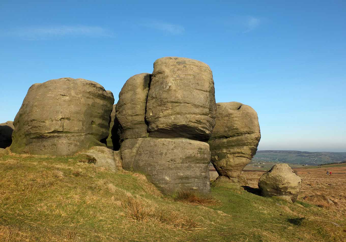
The Bridestones are a striking collection of weathered gritstone rock formations located on the moors above Todmorden, on the West Yorkshire–Lancashire border. These dramatic outcrops, sculpted by thousands of years of wind and rain, stand as some of the most impressive natural features in the South Pennines. Rising from the heather-covered moorland, they have an almost otherworldly appearance, with their unusual shapes and towering presence creating a landscape that feels both ancient and mysterious.
The name “Bridestones” is thought to have possible links to folklore, with some suggesting it refers to ancient ceremonial or ritual significance, though there is no confirmed evidence of prehistoric use. Some of the rocks have deep grooves and hollows, which may be natural weathering, but others speculate that they could be remnants of ancient cup marks, similar to those found on other prehistoric sites in the region. The formations have also long been used as boundary markers, with the rocks sitting on the old county divide between Lancashire and Yorkshire.
Popular with walkers, climbers, and photographers, the Bridestones offer stunning views over the Calder Valley, with Todmorden below and the rolling Pennine hills stretching into the distance. The moors surrounding them are rich in wildlife, with curlews, kestrels, and hardy sheep often seen wandering among the rocks. The formations are part of a wider landscape steeped in history and legend, making them an enduring point of interest for those drawn to the wilder side of Yorkshire’s uplands.
Created: 18 March 2025 Edited: 2 May 2025
The Bridestones on Bridestones Moor
The Bridestones on Bridestones Moor LiDAR Map

Contains public sector information licensed under the Open Government Licence v3.0
Local History around The Bridestones on Bridestones Moor
There are some historic monuments around including:
Bowl barrow 155m east of Beadle HillBeadle Hill Romano-British farmsteadBowl barrow on Hameldon PastureWayside cross known as Mount CrossRound cairn on Hameldon PastureWayside cross known as Reaps CrossTwo Romano-British farmsteads known as Ring StonesRing cairn 25m east of Ell CloughSmall stone circle on Delf HillEnclosed Bronze Age urnfield 200m north west of Hanging Field FarmSaucer barrow 90m east of Ell CloughBowl barrow 140m east of Beadle HillTwist Castle Romano-British farmsteadBowl barrow 90m east of Twist CastlePike Low bowl barrow and site of beacon, Bonfire Hill.


