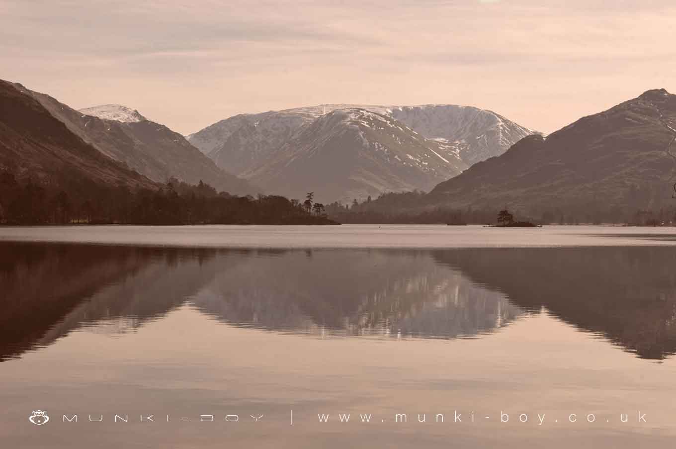
Hartsop Dodd and Stony Cove Pike Overlooking Ullswater by munki-boy
Stony Cove Pike [Caudale Moor]
Stony Cove Pike [Caudale Moor] is in The Lake District National Park in England.
A prominent mountain at the foot of the Ullswater valley, with notably massive caulderas on all sides.
Created: 25 October 2020 Edited: 29 November 2023
Stony Cove Pike [Caudale Moor] Details
Stony Cove Pike [Caudale Moor] is a 763 metre high mountain in Cumbria.
Stony Cove Pike [Caudale Moor]
Stony Cove Pike [Caudale Moor] LiDAR Map
![A LiDAR Map showing the area around Stony Cove Pike [Caudale Moor]](data:image/png;base64,iVBORw0KGgoAAAANSUhEUgAAAAEAAAABCAYAAAAfFcSJAAAADUlEQVR42mNkYPhfDwAChwGA60e6kgAAAABJRU5ErkJggg==)
Contains public sector information licensed under the Open Government Licence v3.0
Local History around Stony Cove Pike [Caudale Moor]
There are some historic monuments around including:
Round cairn 60m east of Hagg GillAmbleside Roman fort, associated vicus and Roman roadRound cairn 75m east of Hagg GillPrehistoric rock art at Place Fell Cottage, 370m north east of Goldrill BridgeHigh Street, Roman roadLow Kingate concentric stone circleMedieval shieling 150m west of Trout BeckRound cairn 80m east of Hagg GillPrehistoric rock art in Patterdale 270m north west of CrookabeckMillrigg Romano-British enclosed hut circle settlementRound cairn 200m south-south-west of Bluegill FoldNorthern round cairn on north end of The Tongue, Troutbeck ParkMedieval shieling 640m north of Troutbeck Park FarmPrehistoric rock art in Patterdale 40m north west of BeckstonesMedieval shieling 100m west of Trout BeckMyers Head lead mineHogget Gill lead smelting mill, water management system and wood drying kilnMedieval shieling 70m west of Trout BeckPrehistoric rock art at Green Rigg, 310m north east of Goldrill bridgeRound cairn 250m south-south-west of Bluegill FoldRomano-British enclosed stone hut circle settlement and Romano-British farmstead north west of Tongue House Barn.Prehistoric rock art, 150m south west of Nook EndRomano-British enclosed stone hut circle settlement at Heck Beck, BannerdaleRound cairn on High RaiseRomano-British enclosed stone hut circle settlement and round cairn 350m south of Hartsop HallSouthern round cairn on north end of The Tongue, Troutbeck ParkRound cairn 15m east of Hagg GillSettlement on W slope of The Tongue, Troutbeck Park.


![Stony Cove Pike [Caudale Moor] UK Map](https://www.landscapebritain.co.uk/image/1/260/0/uploads/location-maps/stony-cove-pike-caudale-moor.jpg)