Lund's Tower by munki-boy
Lund's Tower
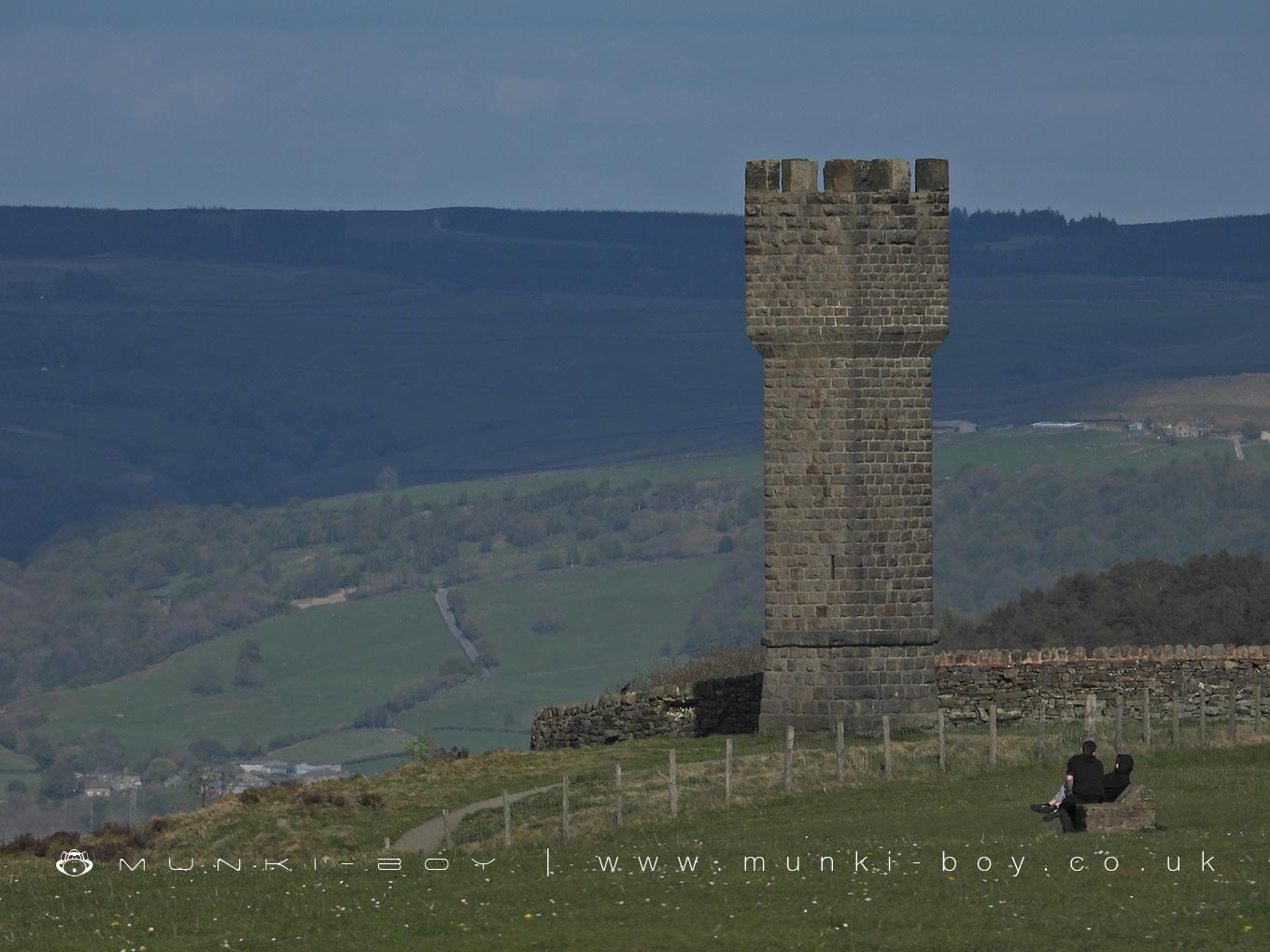
Lund’s Tower stands proudly on Earl Crag, overlooking the villages of Cowling and Sutton-in-Craven. Built in 1887 by local industrialist James Lund, the tower was intended as a Victorian folly, serving as both a landmark and a place from which to enjoy the surrounding views. Some accounts suggest it may have been constructed to commemorate Queen Victoria’s Golden Jubilee, while others hint that it was built for Lund’s daughter, possibly named Ethel, to provide her with a spot to admire the landscape.
Constructed from squared dressed stone, Lund’s Tower is square in plan and topped with corbelled battlements. A plinth forms its base, and inside a spiral stone staircase of 39 steps winds its way to a viewing platform. From the top, visitors can enjoy panoramic views across the Aire Valley and towards the hills of Lancashire and the Yorkshire Dales.
Although a plaque once adorned the tower, it is now illegible, leaving much of the structure’s original dedication to speculation. The tower first appears on Ordnance Survey maps in the late 19th century, confirming its construction shortly after 1887. Together with nearby Wainman’s Pinnacle, Lund’s Tower forms part of a locally cherished landscape. The two structures are often referred to as the “Salt and Pepper Pots,” a nickname reflecting their contrasting shapes and their striking appearance on the skyline.
Today, Lund’s Tower remains a favourite destination for walkers and locals, a testament to the Victorian era’s love of picturesque monuments and the lasting impact of individual ambition on the landscape.
Created: 26 April 2025 Edited: 30 April 2025
The Salt and Pepper Pots


Lund's Tower
Local History around Lund's Tower
There are some historic monuments around including:
Black Hill round cairnRock with at least six cups 170m north west of Grey Stones FarmOre hearth smeltmill and wood drying kiln in Lumb Clough Wood, 350m south east of Bank FootCup marked rock on north side of barn, 100m north west of the Grey Stones FarmKildwick BridgeRock with one cup in east end of Great Wood Plantation, 375m NNE of Cawder Hall Farm, Horse Close HillRock with one cup at the base of a wall, 250m NNE of Cawder Hall Farm, Horse Close HillRock with at least 15 cups 240m south of Great Wood Laithe, Horse Close HillCup and ring marked rock 150m west of Low Edge Farm, Bradley MoorRock with at least one cup mark 310m east of Cawder Hall FarmLong barrow and superimposed round cairn on Black HillTwo carved rocks in field 130m north east of Cawder Hall Farm, Horse Close HillCarved rock on bank at side of track opposite Garth House, 60m south west of Snaygill FarmRock with one cup in field south east of Great Wood Plantation, 450m north east of Cawder Hall Farm, Horse Close HillSubcircular enclosed settlement on Horse Close Hill 250m north of Horse Close FarmCup, ring and groove marked rock south of derelict wall on Bradley Moor, 70m south west of Low Edge FarmHanging Stone or Watersheddles CrossCup and ring marked rock in wall at High Snaygill 80m east of High Laithe.


