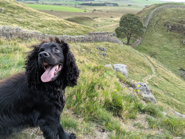
Hadrian's Wall near Hexham by Hannah Blundell
Hadrian's Wall near Hexham
Hadrian's Wall near Hexham is in Northumberland National Park in England.
A section of Hadrian’s Wall running by the famous Vindolanda excavated Roman fort and village, Milecastle 39 and Housesteads.
Created: 3 July 2021 Edited: 29 November 2023
National Trust Sycamore Gap Information
National Trust Sycamore Gap Address
Henshaw, Hexham, Northumberland
NE47 7
Website: https://www.nationaltrust.org.uk/holidays/peel-bothy-northumberland
Get directionsHadrian's Wall near Hexham LiDAR Map

Contains public sector information licensed under the Open Government Licence v3.0
Local History around Hadrian's Wall near Hexham
There are some historic monuments around including:
Camp in Oakwood SE of Plenmeller villageRoman quarry inscription on Queen's Crags, 680m south east of East HotbankRound cairn, 150m ESE of Kingscrag GateRomano-British farmstead, 250m east of King's CragsStone circle, 380m east of King's CragsThree round cairns, 500m east of King's CragsHadrian's Wall and vallum between the road to Caw Gap and the Caw Burn in wall miles 41 and 42The vallum between the road to Steel Rigg car park and the road in Caw Gap in wall miles 39, 40 and 41Milestone House Roman temporary camp and section of the Stanegate Roman roadRound cairn 380m north of Codley GateHadrian's Wall, associated features and a Romano-British settlement between the road to Steel Rigg car park and the road through Caw Gap in wall miles 39 to 41Prehistoric settlement 230m north of BradleySeatsides 1 Roman temporary camp and section of the Stanegate Roman road from the west side of the road from Once Brewed to the south side of the B6318Hadrian's Wall and associated features between the field boundary west of turret 37a and the road to Steel Rigg car park in wall miles 37, 38 and 39Round cairn 450m north east of East CrindledikesThree prehistoric and Romano-British settlements and associated cord rig at Green BraeBean Burn 2 Roman temporary campBastle at Grandy's KnoweThe vallum and a British settlement between the field boundary west of turret 37a and the road to Steel Rigg car park, in wall miles 37, 38 and 39Round cairn, 120m ENE of Kingscrag GateStaward peleMedieval settlement and field system, two bastles and a corn drying kiln, immediately north east of Bradley HallDefended settlement and Roman signal station 410m south of West CrindledikesVindolanda (Chesterholm) Roman forts, civil settlement and cemeteries, adjacent length of the Stanegate Roman road and two milestonesRing cairn and shieling immediately west of Chatley CragsBowl barrow 420m south west of New BeggarbogThe vallum and early Roman road between the field boundary east of turret 34a and the field boundary west of milecastle 36 in wall miles 34, 35 and 36Stone circle, defended settlement, Romano-British farmstead and field system, Roman camp and group of shielings immediately south of Greenlee LoughMare and Foal stone circle, 400m north east of Milestone HouseHousesteads fort, section of Wall and vallum between the field boundary west of milecastle 36 and the field boundary west of turret 37a in wall miles 36 and 37Shieling and associated building 1.45km west of Blue HemmelRound cairn, 120m south of King's CragsBean Burn 1 Roman temporary campHaltwhistle Burn Roman temporary camps 2 and 3 and area of cord rig cultivationTwice Brewed Roman temporary campRound cairn, 150m east of Kingscrag GateSeatsides 2 Roman temporary campWillimontswyke (uninhabited portions).


