Glusburn by munki-boy
Glusburn
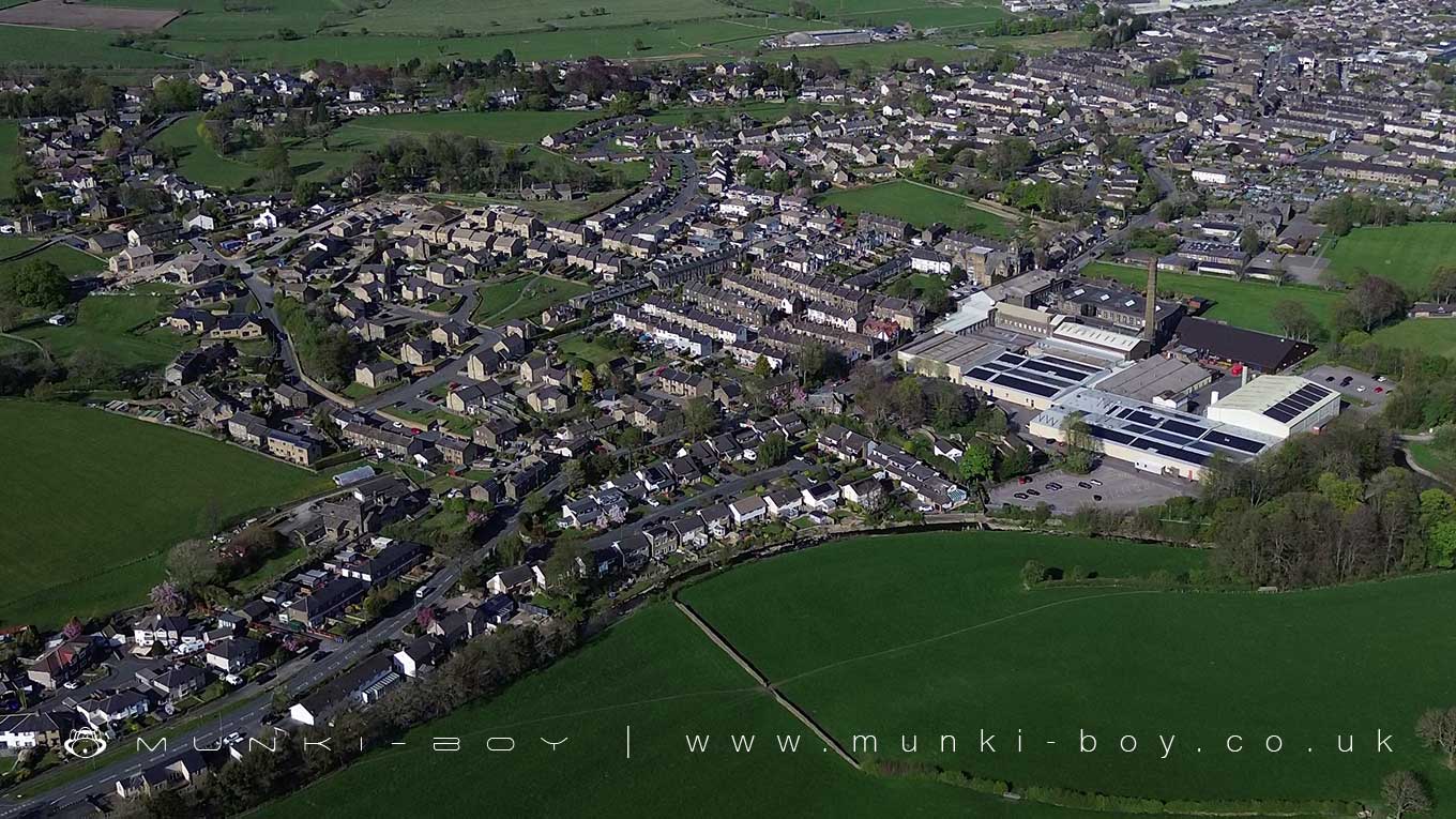
Glusburn is a village and civil parish in North Yorkshire, England, located on the edge of the Yorkshire Dales. It forms part of the civil parish of Glusburn and Cross Hills and sits within the Aire Valley, surrounded by the hills of the eastern Pennines.
The village’s history likely stretches back to the 8th century. It was recorded in the Domesday Book of 1086 as “Glusebrun,” meaning “shining stream.” Originally a small farming community, Glusburn developed significantly during the 19th century with the rise of the textile industry, becoming closely associated with the mills that shaped the local economy.
One of the key historic buildings in Glusburn is Glusburn Old Hall, which served as the local manor house. The current structure dates mainly from 1637, although a recut stone suggests an earlier date of 1537. Over time, it was converted into farm cottages before being restored into a single dwelling. It is a Grade II listed building. Another important building is the Glusburn Institute, founded in 1892 by John Horsfall to provide a place for education and recreation without the influence of alcohol. Today, it operates as the Glusburn Community and Arts Centre and is also Grade II listed.
Glusburn offers a range of local amenities including shops, schools, and recreational facilities. The village has a strong sense of community, with various events and activities throughout the year. Its location provides easy access to the Yorkshire Dales and nearby countryside, making it popular with walkers and nature lovers.
Today, Glusburn maintains a balance between its historical roots and modern village life, making it a notable part of the Craven district in North Yorkshire.
Created: 26 April 2025 Edited: 2 May 2025
Glusburn
Local History around Glusburn
There are some historic monuments around including:
Rock with at least one cup mark 310m east of Cawder Hall FarmCup marked rock on north side of barn, 100m north west of the Grey Stones FarmKildwick BridgeRock with one cup in field south east of Great Wood Plantation, 450m north east of Cawder Hall Farm, Horse Close HillRock with at least 15 cups 240m south of Great Wood Laithe, Horse Close HillLong barrow and superimposed round cairn on Black HillCarved rock on bank at side of track opposite Garth House, 60m south west of Snaygill FarmPark Hill earthworkBlack Hill round cairnCup and ring marked rock in wall at High Snaygill 80m east of High LaitheRock with one cup in east end of Great Wood Plantation, 375m NNE of Cawder Hall Farm, Horse Close HillRock with one cup at the base of a wall, 250m NNE of Cawder Hall Farm, Horse Close HillCup, ring and groove marked rock south of derelict wall on Bradley Moor, 70m south west of Low Edge FarmCup and ring marked rock 150m west of Low Edge Farm, Bradley MoorRock with at least six cups 170m north west of Grey Stones FarmHanging Stone or Watersheddles CrossSubcircular enclosed settlement on Horse Close Hill 250m north of Horse Close FarmOre hearth smeltmill and wood drying kiln in Lumb Clough Wood, 350m south east of Bank FootTwo carved rocks in field 130m north east of Cawder Hall Farm, Horse Close Hill.


