Former Church of St Nicholas in Worcester by Arthur S
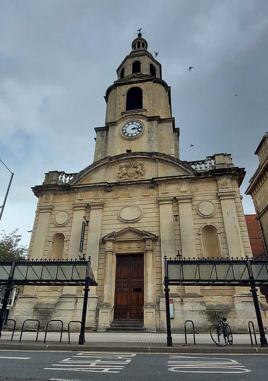
Former Church of St Nicholas in Worcester
The architect of this church has been a matter of dispute, in 1968 Pevsner thought it was Humphrey Hollins. While in 1978 Colvin attributed a new gallery of 1790 to Thomas Johnson of Warwick and Worcester. However, in 1980 Baker attributed it to Thomas White, as did the 1971 List. Later in 1985 Cruikshank thought it by Humphrey Hollins though notes it is also attributed to Thomas White.
The design of the tower is taken from Gibbs ‘Book of Architecture’, which came out in 1728, Cruikshank states that: ‘perhaps the most impressive of Gibbs-derived towers is that sported by St Nicholas, Worcester, which is based almost exactly on a published unbuilt version for St Martin’s(-in-the-Field).’
Created: 11 June 2021 Edited: 29 November 2023
Former Church of St Nicholas in Worcester
Local History around Former Church of St Nicholas in Worcester
There are some historic monuments around including:
Powick BridgeCity walls: section S of The Butts, extending 150ft (50m) between Angel Place and Bath CottageMoated monastic grange and fishpond complex at Middle Battenhall Farm, 450m north of Upper Battenhall FarmHawford Roman campEnclosure W of Church FarmCity walls: section S of The Butts, extending 100ft (30m) E from Rack AlleySt Alban's ChurchCity walls: section extending 90ft (30m) under the E walls of Nos 2-5, No 1 Court, New StreetDisc barrow 500m south of Common FarmRefectory of St Mary's Priory in Cathedral CloseMoated site at Earl's CourtRemains of Guesten HallCity walls: section extending 130ft (40m) from the back of No 27 New Street to Windsor RowDovecote at Hawford GrangeCity walls: section extending 130ft (40m) between Charles Street and Portland PlaceFort RoyalGrimley churchyard crossMotte castle, moated site, and medieval agricultural remains at Crookbarrow FarmCity walls: section extending 85ft (30m) along W side of Talbot StreetCity walls: section extending 280ft (90m) W and SW of Clare StreetDisc barrow 400m SSE of Common FarmDisc barrow 400m south of Common FarmWestern range of monastic buildings of the Cathedral PrioryChurchyard cross in St Mary the Virgin's churchyardWorcester city centreEnclosure 110yds (100m) N of St Bartholomew's ChurchCivil War fieldwork at Tamar Close, WorcesterMedieval fishponds and ridged cultivation remains, east of Grimley villageEdgar Tower entrance to the Cathedral CloseCity walls: section extending 50ft (15m) between Windsor Row and Nash's Passage.


