Crooked Edge Waterfall by munki-boy
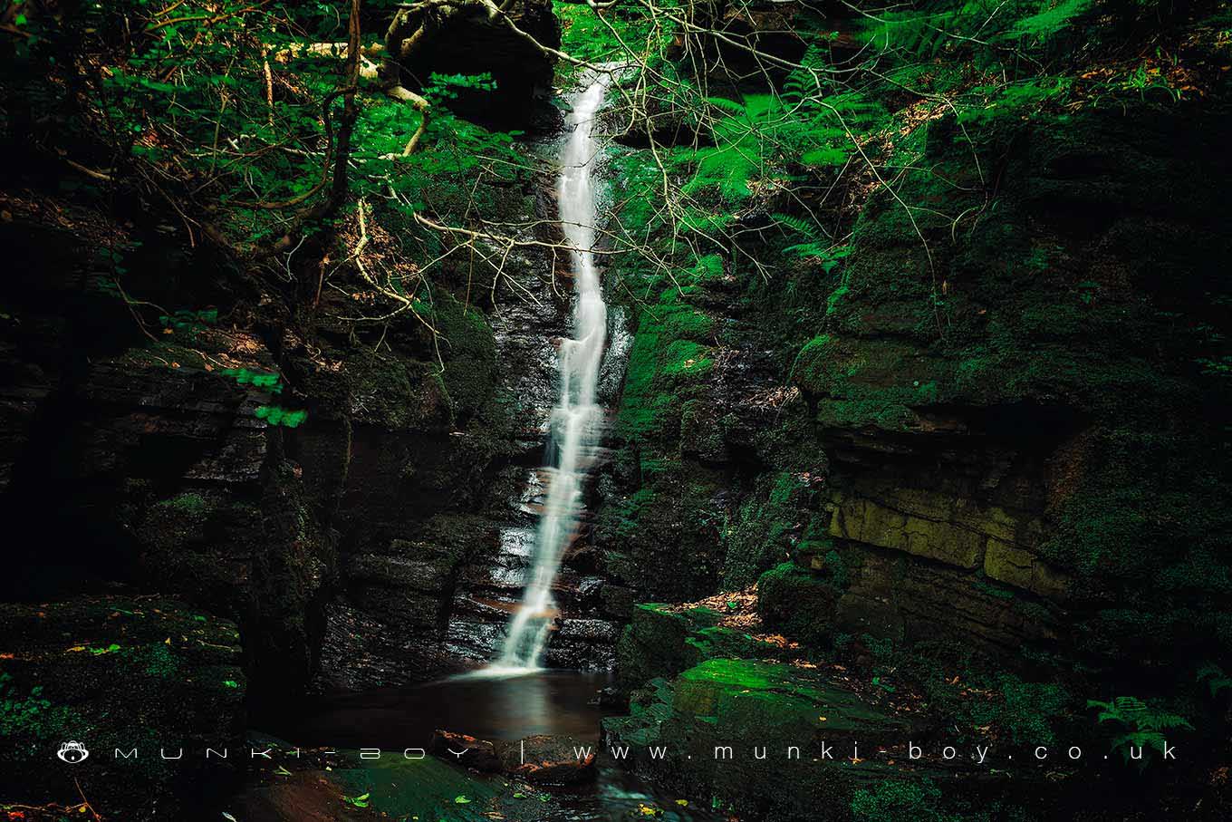
Crooked Edge Waterfall
The Crooked Edge waterfall is located just above the confluence of the Crooked Edge Brook and the River Douglas and is adjacent to the larger Tigers Clough waterfall.
The area is often overgrown and the view from downstream is often choked with large logs and sections of fallen trees washed down after storms.
Crooked Edge waterfall is often disappointingly dry but on a good day the small rocky alcove into which the water falls can be delightfully verdant.
As mentioned elsewhere the area can be plagued by litter.
Created: 24 April 2019 Edited: 29 November 2023
Crooked Edge Waterfall
Crooked Edge Waterfall LiDAR Map

Contains public sector information licensed under the Open Government Licence v3.0
Local History around Crooked Edge Waterfall
There are some historic monuments around including:
Round Loaf bowl barrow on Anglezarke MoorBretters Farm moated site and two fishpondsRound cairn on Noon HillHeadless Cross, GrimefordRound cairn on Winter HillGidlow Hall moated site, Aspull, 560m NNE of Pennington HallPike Stones chambered long cairnThe Moat House moated site 600m WNW of St David's ChurchRound cairn 280m west of Old Harpers Farm.