Church of St Peter - Rylstone by munki-boy
Church of St Peter - Rylstone
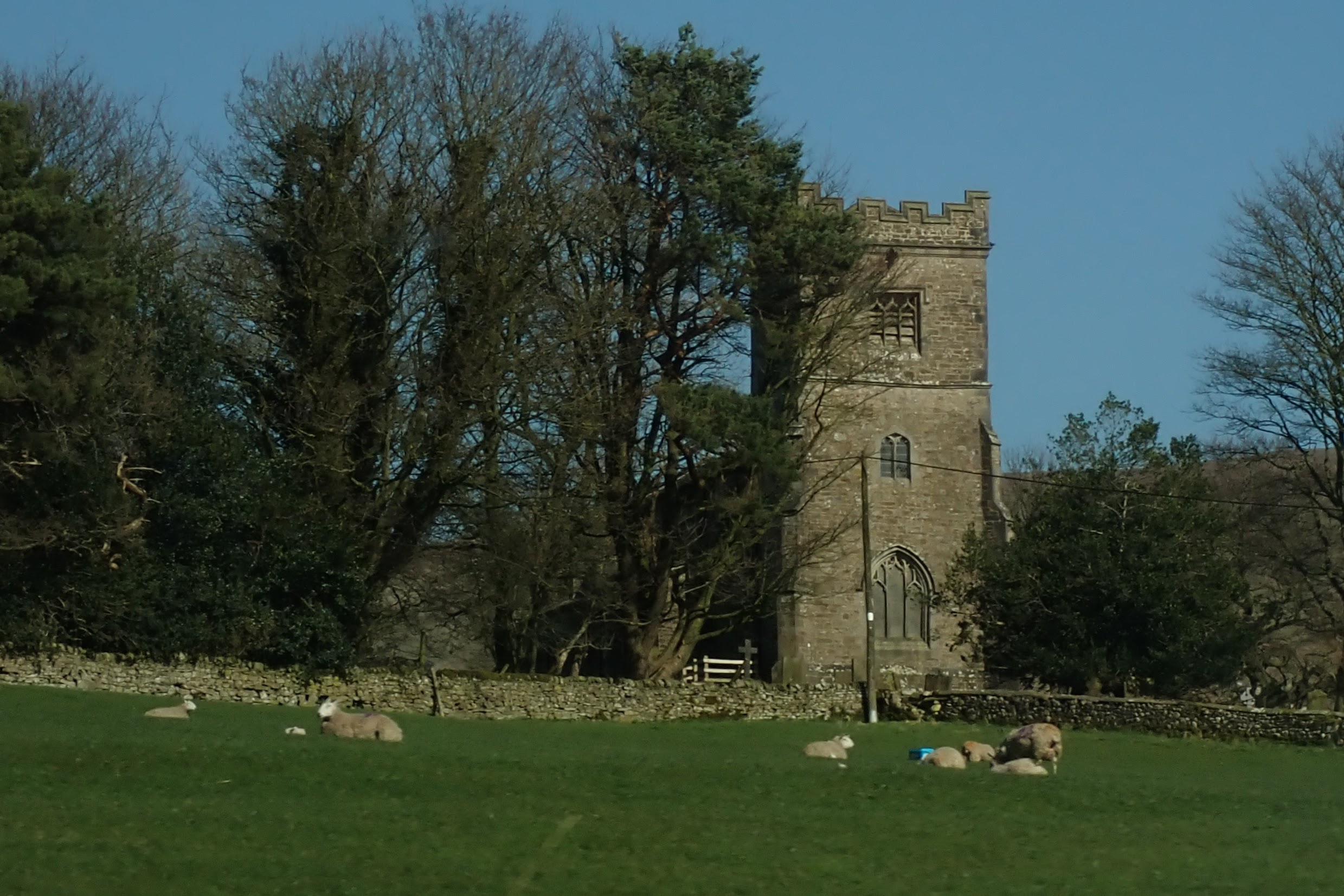
Church of St Peter - Rylstone is in The Yorkshire Dales National Park in England.
St Peter’s Church in Rylstone, North Yorkshire, is a Grade II listed Anglican parish church that continues to serve the local communities of Rylstone, Cracoe, Hetton, and Bordley. The present building was constructed between 1852 and 1853 to replace an earlier church on the same site. It was designed by the Lancaster architect E.G. Paley, a prominent figure in Victorian ecclesiastical architecture. The construction cost around £1,700, with financial support from local benefactor Richard Waddilove.
The church is built from coursed gritstone with a stone slate roof and features a combination of Decorated and Perpendicular Gothic architectural styles. Its layout includes a four-bay nave and chancel in a single range, flanked by north and south aisles. There is a south porch and a three-stage west tower with diagonal buttresses and a crenellated parapet. The tower contains a ring of three bells, cast in 1853 by Charles and George Mears at the Whitechapel Bell Foundry in London.
Inside, the church has arcades supported by octagonal pillars. Both the pulpit and the font date from the time of the church’s construction. A two-manual organ, built in 1932 by Albert Keates, adds to the interior fittings. In the churchyard, there are four war graves: two from the First World War, and two from the Second. These include a Yorkshire Regiment officer, a Royal Navy seaman, a Royal Artillery soldier, and an airman.
St Peter’s is part of the benefice of Linton, Burnsall, and Rylstone, within the deanery of Skipton and the Diocese of Leeds. Though modest in size, the church remains an active part of village life and stands as a well-preserved example of 19th-century ecclesiastical design in the Dales.
Created: 4 April 2025 Edited: 2 May 2025
Church of St Peter - Rylstone
Local History around Church of St Peter - Rylstone
There are some historic monuments around including:
Park Hill earthworkGrassington enclosuresCalton Gill round cairnHydro-electric power house and associated weir 250m north west of Tin BridgeCairns and settlements on Lea GreenCairn on Haw HillCairn in Brazen Gate Woods 260m NNE of Long AshesYarnbury henge monumentRoman villa at Kirk SinkTwo settlements in Grass WoodScale Hill round cairnSettlement SE of Druid's AltarRedmayne packhorse bridgeDruid's Altar four poster stone circlePrehistoric unenclosed hut circle settlement and associated field system at Little WoodSettlement at Chapel House WoodLinton churchyard cross and sundialMedieval monastic wayside cross baseCup marked rock in wall east of Scarnber Wood, 500m north east of Bark Laithe, WinterburnPillow mounds east of Friars Head, known as Giants' GravesMedieval farmstead and field system, 530m south east of The GrangeMoated site W of Paget HallKilnsey Moor settlementHigh Wood bowl barrow.


