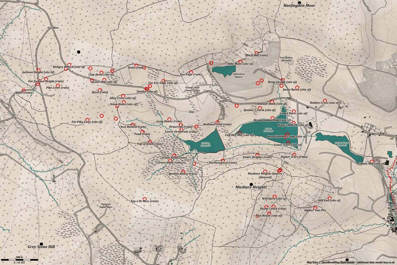
Ruins in Haslingden Grane
The Grane Valley at Haslingden is littered with the ruins of farms and hand-weaving loomshops, the signs of changing landscape use during the industrial revolution. The changes started around the time Bury Council started to buy up land in preparation for the construction of the reservoirs and late the Bury and Radcliffe Waterworks Company who also bought surrounding land and land higher up the valley for water catchement.
Farming began to decline but many of the smallholdings set up loomshops which kept them going but by the turn of the 20th Century most of the old farms were deserted with very few remaining active today. The numbers of people arriving in the mill towns to work and the growth of industry demanded water so the reservoirs were built here and around many of the old mill towns.
Some of the lost farms of Haslingden Grane:
- Hartley House
- Ormerods
- Lower Ormerods
- Close Bottom
- Pike Lowe Dole
- Middle Pike Lowe
- Far Pike Lowe
- Top of Knoll
- Peak
- Bentley House
- Clough Side
- Northampton
- Under Heights
- Higher Scars
- Lower Scars
- Broad Holden Fold
- Quaker’s Farm
- King’s Hillock
- Higher Tan Pits
- Rothwell Fold
- Bottom of the Rough
- Alley Cross
- Far Sight House
- Higher Alley Cross
- Hungry Hillock
- Moor Cock
- Pike Lowe
- Newfield
- Lot Stoops
- Jackson Height
- Far Jackson Height
- Clap Head
- Knowsley
- Higher Doles
- Foe Edge
- Dilly Moor