The King Stone by munki-boy
The King Stone
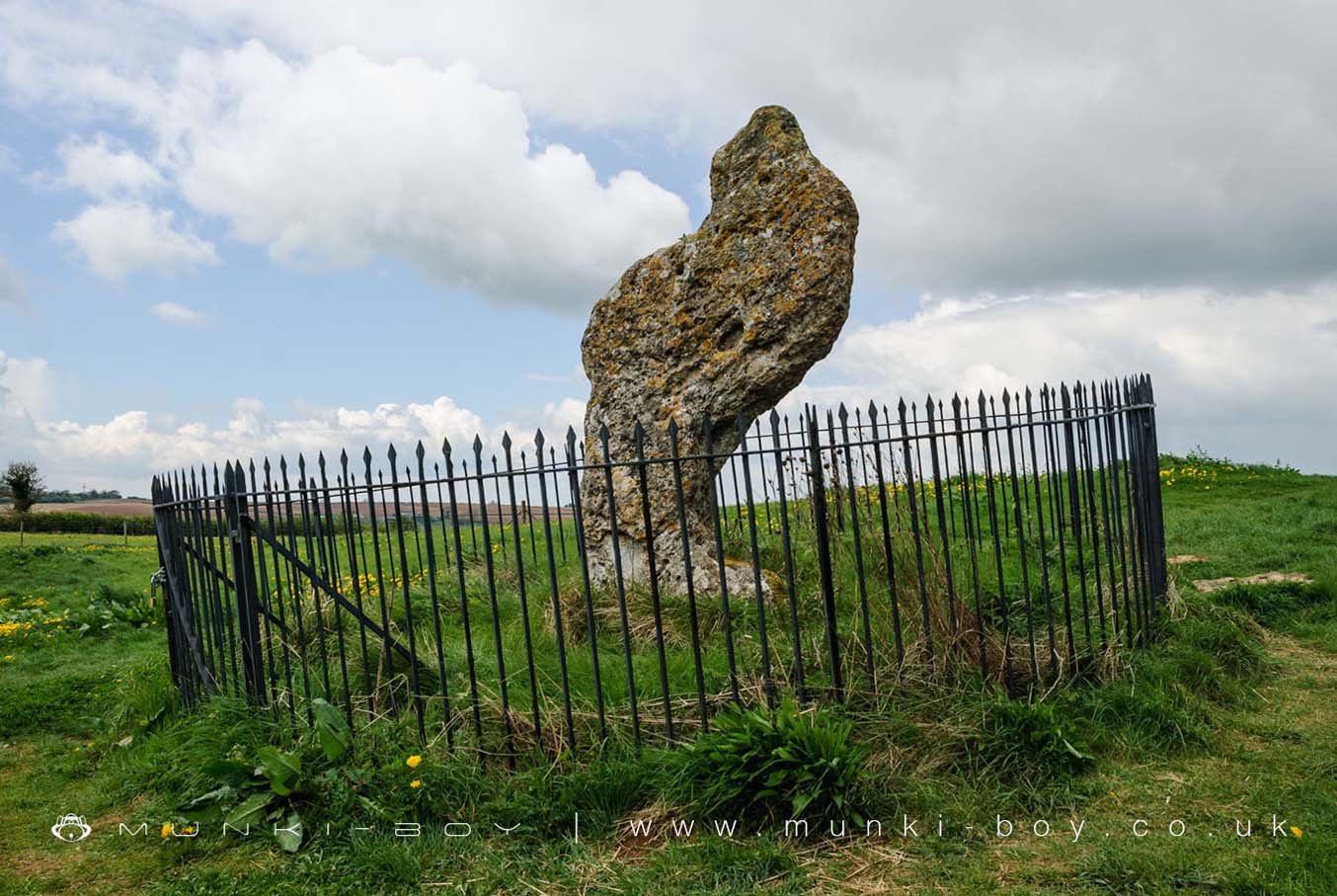
The King Stone is a large block of limestone about 2.5 m. high and now tipped at a rakish angle. This was the marker stone for an early Bronze Age cemetery. Several small cairnst containing cremations were discovered around the stone during excavations in 1979.
The Whispering Knights is part of The Rollright Stones complex.
The King Stone is in Cotswolds AONB, a designated Area of Outstanding Natural Beauty.
Created: 8 July 2018 Edited: 29 November 2023
The King Stone
The King Stone LiDAR Map

Contains public sector information licensed under the Open Government Licence v3.0
Local History around The King Stone
There are some historic monuments around including:
Moated site 300m east of Stourton Methodist ChapelLong barrow on Adlestrop HillChastleton Barrow camp: a hillfort south of Barrow HouseIron Age enclosed settlement and part of a trackway 150m north east of the King StonePortal dolmen 400m south east of Burnt HillThe Mount bell barrow 110m south west of Mount FarmOver Norton bowl barrow 150m north west of the intersection between the A361 and the A34(T)Besbury Lane bowl barrow, 450m north east of Conduit FarmThe Rollright StonesShrunken medieval village NW of Churchill old churchMoated site at Manor FarmMoated siteHawk Stone standing stone 700m south of Claridges BarnNeolithic long barrow 400m SSE of Burnt HillLowland Barn Romano-British farmstead 200m north west of Bury HillGreat house site, garden earthworks and associated remains immediately north, west and south of St Mary's ChurchChipping Norton motte and bailey castle, and fishpondSquire's Clump Anglo-Saxon burial mound 500m south west of Iron BuildingsMoated site, 230m west of St Michael's Church.